2000s (21st Century) Maps of La Pointe, Wisconsin
Explore 12 historic maps of La Pointe from the 2000s (21st Century). These maps offer a rare glimpse into what life looked like during the 2000s — showing old roads, neighborhoods, homes, and landmarks that have changed or disappeared over time.
Whether you're researching your family's past, planning a metal detecting trip, or studying how La Pointe's landscape evolved across the 2000s, these high-resolution maps are a powerful tool for exploring the history of this region.
- Focus on a specific era: All maps on this page are from the 2000s, giving you a focused view of this time period.
- See what’s changed: Compare century-old streets, trails, and buildings to today's modern landscape using overlays and satellite layers.
- Research with precision: Use these maps for genealogy, historical research, land use analysis, or educational projects.
- View, download, or print: Maps are fully viewable online in high resolution, and can be downloaded or printed for your own records.
Start exploring La Pointe's history through authentic maps from the 2000s. This is your window into the past.
La Pointe, WI maps
(12)- 2022 Map of Rocky Island, 2022 Print
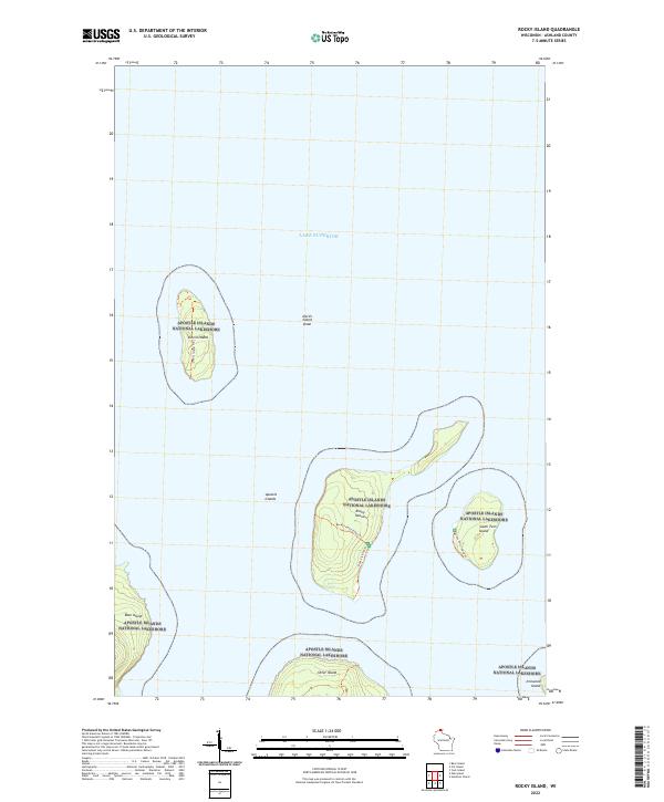 2022 Rocky Island2022 Print · USGSThe northern archipelago of the Apostle Islands National Lakeshore appears in this recent survey of Ashland County's shoreline. Researchers can trace remote island paths like the Rocky Island Steps Trl and identify landmarks from Devils Island to Ironwood Island.
 - 2022 Map of Cat Island, 2022 Print
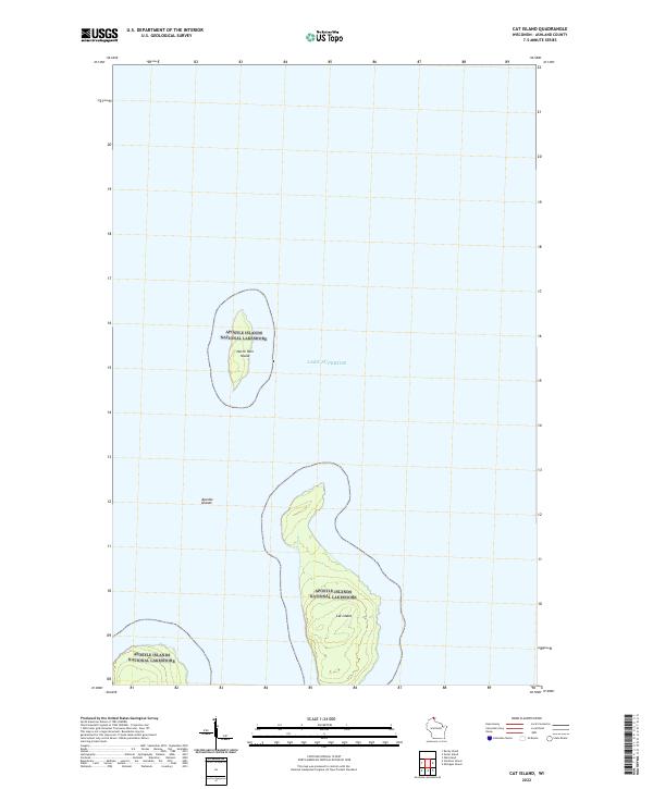 2022 Cat Island2022 Print · USGSThe Apostle Islands sit isolated in Lake Superior during the early twenty-first century. Researchers can trace the protected shorelines and interior terrain of Cat Island and North Twin Island within the Apostle Islands National Lakeshore.
 - 2022 Map of Bear Island, 2022 Print
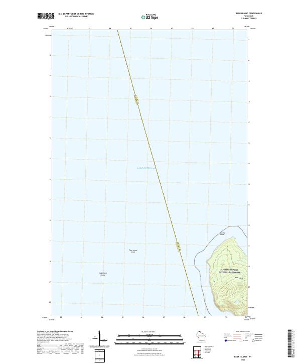 2022 Bear Island2022 Print · USGSBear Island and the surrounding waters of Lake Superior are shown in detail during the early 2020s. Researchers can trace the protected boundaries of the Apostle Islands National Lakeshore and locate underwater features like Bear Island Shoal.
 - 2022 Map of Outer Island, 2022 Print
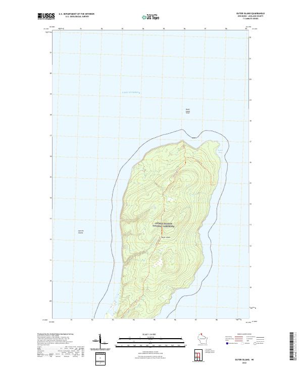 2022 Outer Island2022 Print · USGSThe northernmost reach of the Apostle Islands is documented here in the early twenty-first century. Researchers can trace the path of the North-South Trl across the island's interior or locate the sheltered waters of Austad Bay along the eastern coast.
 - 2022 Map of Madeline Island, 2022 Print
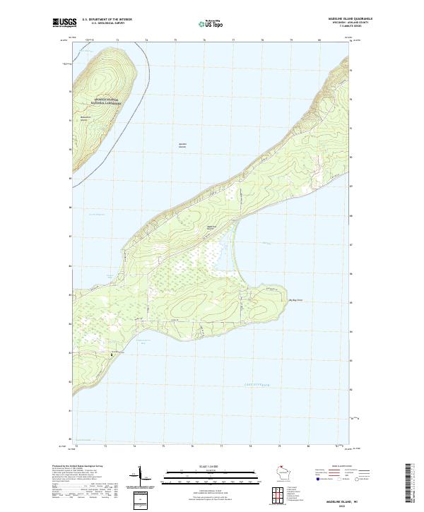 2022 Madeline Island2022 Print · USGSMadeline Island and its surrounding waters are captured in this modern survey of the Apostle Islands archipelago. Genealogists and local historians can locate the Greenwood Cem and trace the road network connecting Big Bay Point and Sunset Bay.
 - 2022 Map of Bayfield, 2022 Print
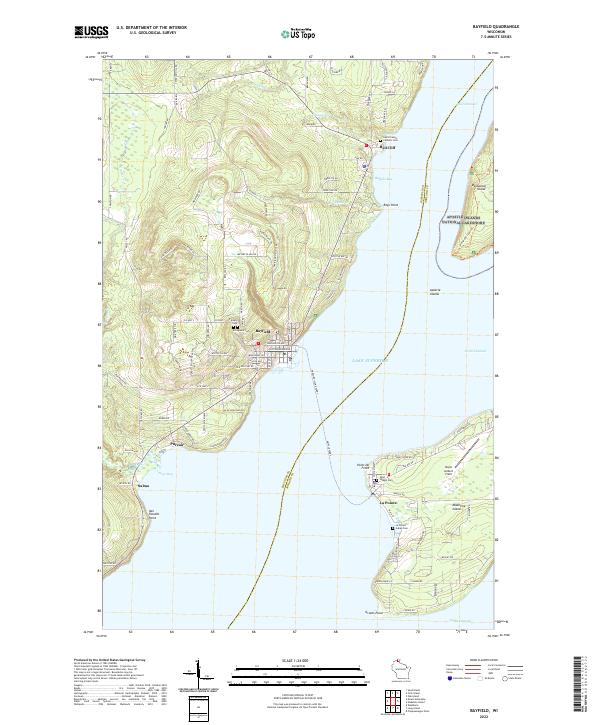 2022 Bayfield2022 Print · USGSCoastal Wisconsin and the surrounding waters of Lake Superior are shown here in the early twenty-first century. Genealogists and local historians can trace burial sites like the La Pointe Indian Cem and Saint Francis Catholic Cem, or explore the geography of Basswood Island and Madeline Island.
 - 2022 Map of Michigan Island OE S, 2022 Print
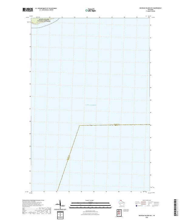 2022 Michigan Island OE S2022 Print · USGSOpen waters of northern Wisconsin meet the shore in the early 2020s, showcasing the maritime border of the northern counties. Researchers can trace the water boundary between Ashland Co and Iron Co or study the coastal fringe of the Apostle Islands National Lakeshore.
 - 2022 Map of Michigan Island, 2022 Print
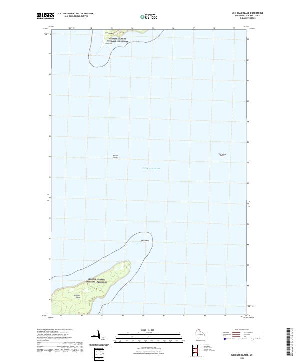 2022 Michigan Island2022 Print · USGSThe Apostle Islands archipelago is captured in this recent coastal survey, focusing on the southern tips of the outer chain. Researchers can trace the boundaries of the Apostle Islands National Lakeshore across Michigan Island and Gull Island.
 - 2022 Map of Stockton Island, 2022 Print
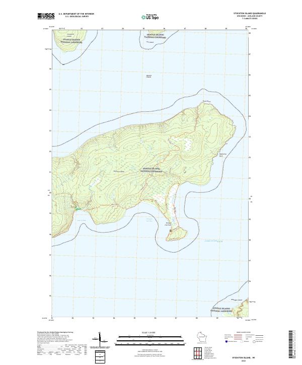 2022 Stockton Island2022 Print · USGSThe Apostle Islands archipelago is captured here in the early twenty-first century, focusing on the complex coastline of Stockton Island. Hikers and maritime historians can trace the paths to Balancing Rock or explore the sheltered waters of Quarry Bay and Presque Isle Bay.
 - 2022 Map of Amnicon Point, 2022 Print
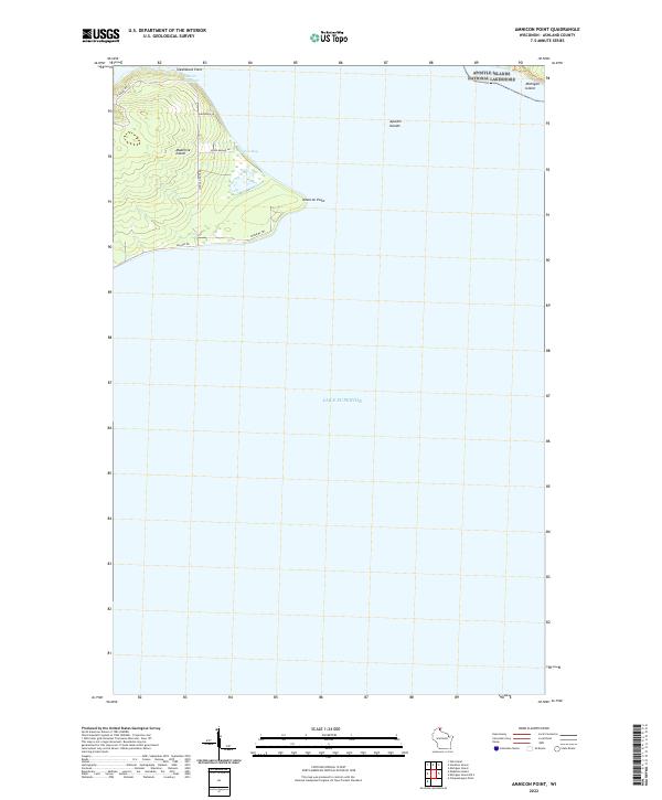 2022 Amnicon Point2022 Print · USGSMadeline Island and the surrounding Apostle Islands are documented here in the early twenty-first century, showcasing the preserved coastal reaches of Ashland County. Researchers can trace land access along Chippewa Trl or locate landmarks like Devils Cauldron and Steamboat Point.
 - 2022 Map of York Island, 2022 Print
 2022 York Island2022 Print · USGSThe northern coast of the Bayfield Peninsula and the surrounding Apostle Islands are documented here in detail during the early 2020s. Researchers can locate landform features like Point Detour, the Ishpiming Akin Cemetery, and the Petit Cache Airport near the shoreline of Lake Superior.
 - 2022 Map of Oak Island, 2022 Print
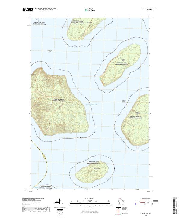 2022 Oak Island2022 Print · USGSThe Apostle Islands sit within Lake Superior at the dawn of the 2020s, showing a landscape defined by water and wilderness. Researchers can trace the trails and coastal points of this archipelago, including Oak Island, the Clay Banks, and Hermit Island.
End of results
Showing maps 1-12 of 12
Top cities near La Pointe
Top neighborhoods of La Pointe
Frequently asked questions
- What are the different types of historical maps available for La Pointe?
- What is the oldest map of La Pointe?
- Where can I purchase historical maps of La Pointe for my home or office?
- Where can I download high-res historical maps of La Pointe?
- Are there historical topographic maps available for La Pointe?
- Is there historical aerial imagery available for La Pointe?
- Where are historical maps of La Pointe sourced from?