1990s Maps of Johnson County, Wyoming
Explore 19 historic maps of Johnson County from the 1990s. These maps offer a rare glimpse into what life looked like during the 1990s — showing old roads, neighborhoods, homes, and landmarks that have changed or disappeared over time.
Whether you're researching your family's past, planning a metal detecting trip, or studying how Johnson County's landscape evolved across the 1990s, these high-resolution maps are a powerful tool for exploring the history of this region.
- Focus on a specific era: All maps on this page are from the 1990s, giving you a focused view of this time period.
- See what’s changed: Compare century-old streets, trails, and buildings to today's modern landscape using overlays and satellite layers.
- Research with precision: Use these maps for genealogy, historical research, land use analysis, or educational projects.
- View, download, or print: Maps are fully viewable online in high resolution, and can be downloaded or printed for your own records.
Start exploring Johnson County's history through authentic maps from the 1990s. This is your window into the past.
Johnson County, WY maps
(19)- 1993 Map of Lake Helen, 1997 Print
 1993 Lake Helen1997 Print · USGSThe high Bighorn Mountains are captured here in the early nineties, centered on the high-altitude wilderness of Cloud Peak. Hikers and historians can trace the paths of the Solitude Trail through Florence Pass and locate remote outposts like West Tensleep.
 - 1993 Map of Caribou Creek, 1997 Print
 1993 Caribou Creek1997 Print · USGSThe high mountain drainages of Johnson County are captured here in the early nineties, showing a landscape shaped by forestry and grazing. Genealogists and researchers can trace remote sites like Lost Cabin, the Muddy Creek Guard Station, and the historic Stock Driveway.
 - 1993 Map of North Ridge, 1997 Print
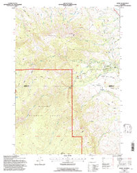
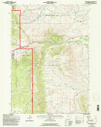 1993 North Ridge1997 Print · USGSJohnson County, Wyoming, is shown here in the 1990s at the interface of managed rangelands and the Bighorn National Forest. Researchers can trace the legacy of frontier defense along the Old Military Reservation Boundary and map local water history through the Johnson Ditch and Eagle Ditch.2 unique versions available
 - 1993 Map of Shell Lake, 1997 Print
 1993 Shell Lake1997 Print · USGSThe high Bighorn Mountains come into sharp focus in the early nineties, showcasing the alpine lakes and trail systems of the Bighorn National Forest. Backcountry travelers and researchers can trace the historic Edelman Trail through Dutch Oven Pass to remote waters like Little Shell Lake and Lake Geneva.
 - 1993 Map of Klondike Ranch, 1997 Print
 1993 Klondike Ranch1997 Print · USGSJohnson County's eastern Bighorn foothills are captured here in the 1990s, where high-country forest meets the basin's ranching frontier. Researchers can trace historic irrigation routes like the Watkins Ditch and find local landmarks such as Sisters Hill and Klondike Ranch.
 - 1993 Map of Cloud Peak, 1997 Print
 1993 Cloud Peak1997 Print · USGSThe Bighorn Mountains reach their pinnacle in the early 1990s as federal agencies map the high alpine wilderness of Johnson County. Researchers can trace the paths of the Solitude Trail through glacial basins to Lake Geneva, Black Tooth Mountain, and Kearny Reservoir.
 - 1993 Map of Powder River Pass, 1997 Print
 1993 Powder River Pass1997 Print · USGSThe Bighorn Mountains in the early 1990s are defined by high-altitude passes and the protected wilderness of the northern Wyoming range. Researchers can trace the winding Skyway Scenic Byway to Powder River Pass and locate a specific Gold Mine near the North Fork headwaters.2 unique versions available
 - 1993 Map of Meadowlark Lake, 1997 Print
 1993 Meadowlark Lake1997 Print · USGSBighorn National Forest high country comes to life in the early nineties as recreation and forestry intersect. Outdoor historians and genealogists can trace family-named sites and mountain outposts like Meadowlark Lodge, the Tyrell Ranger Sta, and St Christopher in the Bighorn.
 - 1993 Map of Hunter Mesa, 1997 Print
 1993 Hunter Mesa1997 Print · USGSThe high meadows and ranching outposts of the Big Horns are captured here in the early nineties, showing a landscape of forest service camps and mountain resorts. Researchers can trace historic lines like the Old Military Reservation Boundary and locate sites such as Paradise Ranch or Fox Cabin.
 - 1993 Map of Stone Mountain, 1997 Print
 1993 Stone Mountain1997 Print · USGSBighorn National Forest and the Johnson County foothills are documented here in the early 1990s as a landscape of irrigation and conservation. Researchers can trace historical water rights through the Tongue River Buffalo Ditch or locate landmarks like the H F Bar Ranch and Stone Mountain.
 - 1993 Map of Willow Park Reservoir, 1997 Print
 1993 Willow Park Reservoir1997 Print · USGSThe high country of Johnson County in the early nineties reveals a landscape of wilderness management and alpine water storage. Trace the routes of the Solitude Trail to find Happ Cow Camp, Willow Park Reservoir, and Cloud Peak Reservoir.
 - 1993 Map of Onion Gulch, 1997 Print
 1993 Onion Gulch1997 Print · USGSWashakie County ranching and forest lands are captured here in the early nineties, showing a landscape of seasonal high-country camps. Researchers can locate specific pioneer legacies like the Moses Homestead and remote outposts such as Lyman Cow Camp or Hatfield Cabin.
 - 1993 Map of Lake Angeline, 1997 Print
 1993 Lake Angeline1997 Print · USGSThe Bighorn Mountains in the early 1990s remained a stronghold of alpine solitude and glacial hydrology. Backpackers and historians can trace the primitive Solitude Trail through high-altitude landmarks like Lake Angeline and the Seven Brothers Lakes.
 - 1993 Map of Dome Lake, 1997 Print
 1993 Dome Lake1997 Print · USGSHigh-altitude watersheds and granite peaks of the Bighorn Mountains are documented here in the early nineties. Researchers can trace historic water management at Dome Lake Reservoir and Weston Reservoir, or locate landmarks like Saddle Mountain and Preacher Rock.
 - 1993 Map of Hazelton, 1997 Print
 1993 Hazelton1997 Print · USGSThe high country of Johnson County comes into focus in the early nineties, centered on the remote settlement of Hazelton. Genealogists and researchers can locate a marked grave and cabin, or trace old mining prospects and the Hazelton Ditch.
 - 1993 Map of Story, 1997 Print
 1993 Story1997 Print · USGSThe foothills of the Bighorn Mountains come alive in the 1990s, where historical sites meet federal forest lands. Researchers can trace the Wagon Box Battle Monument and nearby Ruins, or locate landmarks like the State Fish Hatchery and Thorn Rider Camp near Story.
 - 1993 Map of Hazelton Peak, 1997 Print
 1993 Hazelton Peak1997 Print · USGSBighorn National Forest and the high country of Johnson County are shown here in the early nineties, during a period of forest management and ranching. Genealogists and historians can trace the Big Horn Mine, the Cow Camp settlement, and early mountain routes like the Gold Mine Road.
 - 1993 Map of Park Reservoir, 1997 Print
 1993 Park Reservoir1997 Print · USGSHigh in the Big Horn Mountains during the 1990s, this area shows a landscape defined by alpine water storage and wilderness retreats. Researchers can trace historic mountain sites like Spear-O-Wigwam Resort, Tepee Lodge, and the remote Bishop Mine.
 - 1993 Map of Little Goose Peak, 1997 Print
 1993 Little Goose Peak1997 Print · USGSHigh in the Big Horn Mountains during the 1990s, this survey captures the intersection of wilderness and historic ranching history. Researchers can locate the Gen Crooks Camp, the Penrose Guard Station, and remote landmarks like Bosin Rock.
End of results
Showing maps 1-19 of 19
Top cities of Johnson County
Frequently asked questions
- What are the different types of historical maps available for Johnson County?
- What is the oldest map of Johnson County?
- Where can I purchase historical maps of Johnson County for my home or office?
- Where can I download high-res historical maps of Johnson County?
- Are there historical topographic maps available for Johnson County?
- Is there historical aerial imagery available for Johnson County?
- Where are historical maps of Johnson County sourced from?