1960s Maps of Johnson County, Wyoming
Explore 55 historic maps of Johnson County from the 1960s. These maps offer a rare glimpse into what life looked like during the 1960s — showing old roads, neighborhoods, homes, and landmarks that have changed or disappeared over time.
Whether you're researching your family's past, planning a metal detecting trip, or studying how Johnson County's landscape evolved across the 1960s, these high-resolution maps are a powerful tool for exploring the history of this region.
- Focus on a specific era: All maps on this page are from the 1960s, giving you a focused view of this time period.
- See what’s changed: Compare century-old streets, trails, and buildings to today's modern landscape using overlays and satellite layers.
- Research with precision: Use these maps for genealogy, historical research, land use analysis, or educational projects.
- View, download, or print: Maps are fully viewable online in high resolution, and can be downloaded or printed for your own records.
Start exploring Johnson County's history through authentic maps from the 1960s. This is your window into the past.
Johnson County, WY maps
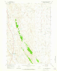
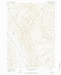
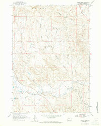
(55)- 1960 Map of Shell Lake, 1962 Print
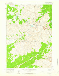 1960 Shell Lake1962 Print · USGSBighorn National Forest in the early sixties remained a backcountry expanse accessible primarily by pack trails and mountain passes. Trace the old routes through Dutch Oven Pass and locate remote landmarks like the Lake Geneva Campground and Teepee Pole Flats.4 unique versions available
 - 1961 Map of Barnum, 1962 Print
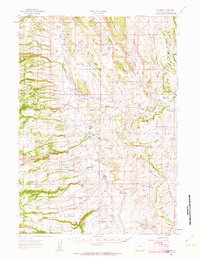 1961 Barnum1962 Print · USGSThe ranchlands of Johnson County come to life in this early 1960s survey of the iconic Powder River country. Genealogists and historians can trace the foundations of local legacy through sites like the Roy Rinker Homestead, Grave Ranch, and the legendary Outlaw Cave.2 unique versions available
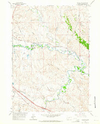
 - 1961 Map of Soldier Creek, 1964 Print
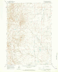
 1961 Soldier Creek1964 Print · USGSJohnson County is shown during the early sixties, where the historic Bozeman Trail traverses a landscape of deep draws and river bends. Local historians can trace the bounds of the Fort Reno Military Reservation and locate old water sources like Palmer Reservoir and Reno Reservoir.
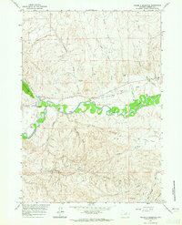
 - 1961 Map of Kaycee NE, 1964 Print
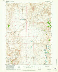
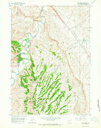
 1961 Kaycee NE1964 Print · USGSJohnson County's ranching and mining heartland is captured here in the early sixties, centered on the Middle Fork Powder River valley. Genealogists and local historians can locate several family operations like Smith Ranch and trace numerous historic mines including the Bybee Mines and Running Mine.3 unique versions available
 - 1961 Map of Fourmile Reservoir, 1964 Print
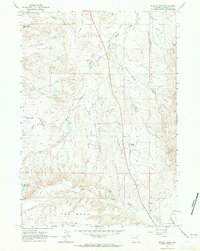
 1961 Fourmile Reservoir1964 Print · USGSRangeland and water management in Johnson County are captured here in the early sixties. Researchers can trace historic water rights and land use through the Fourmile Reservoir, a lone Cem, and the winding Buffalo Sussex Cutoff.
 - 1961 Map of Figure 8 Reservoir, 1964 Print
 1961 Figure 8 Reservoir1964 Print · USGSRanching and oil extraction define the Wyoming landscape along the Powder River during the early sixties. Genealogists and historians can trace family operations like the Streeter Ranch and Koch Ranch or locate the Pioneer Monument and Sutton Sch 1.2 unique versions available
 - 1961 Map of Dry Creek Reservoir, 1964 Print
 1961 Dry Creek Reservoir1964 Print · USGSJohnson County ranching and sheep herding come to life in this early sixties survey of the Wyoming rangeland. Researchers can trace family-named landmarks like Goyheneix Ranch, the Sippie Mine, and the Lund Sheep Camp along Dry Creek.2 unique versions available
 - 1961 Map of Antelope Draw, 1964 Print
 1961 Antelope Draw1964 Print · USGSJohnson County ranching country is captured here in the early sixties, showing the remote homesteads of the Wyoming high plains. Genealogists can locate the Crain Ranch and the Crain Sch among landmarks like Reno Hill and Ninemile Creek.2 unique versions available
 - 1961 Map of TTT Ranch, 1964 Print
 1961 TTT Ranch1964 Print · USGSJohnson County ranching land is documented here in the early sixties as the cattle economy utilized the river forks. Researchers can trace the water rights of the TTT Ranch along the Powder River and locate remote Claypits and the Bear Lone Road.3 unique versions available
 - 1961 Map of Provence Ranch, 1964 Print
 1961 Provence Ranch1964 Print · USGSThe high plains of Johnson County in the early 1960s reveal a landscape of remote ranching and historic migration routes. Genealogists and historians can trace the path of the Bozeman Trail past Provence Ranch and the small settlement at Bonnidee.
 - 1961 Map of Schlict Draw, 1965 Print
 1961 Schlict Draw1965 Print · USGSJohnson County ranching and water rights are well-documented in the early sixties as the landscape shifts toward modern infrastructure. Trace the historic Old Railroad Grade and find family-named landmarks like Gosney Ranch or Schlict Draw.2 unique versions available
 - 1961 Map of Dugout Ranch, 1965 Print
 1961 Dugout Ranch1965 Print · USGSJohnson County ranching life in the early sixties is preserved here, showing the remote homesteads and vital water infrastructure of the high plains. Researchers can locate family operations at Dugout Ranch and Hull Ranch or trace the path of the regional Pipeline.2 unique versions available
 - 1961 Map of Elaine Draw, 1965 Print
 1961 Elaine Draw1965 Print · USGSJohnson County ranchlands are captured here in the early sixties as the modern road network began to overlay historic migration routes. Researchers can trace the legendary Bozeman Trail past the Eklund Ranch and the Crazy Woman Radio Facility.
 - 1961 Map of Dead Woman Crossing, 1965 Print
 1961 Dead Woman Crossing1965 Print · USGSThe Johnson County plains in the early sixties reveal a landscape defined by ranching and energy extraction. Researchers can trace the layout of the West Sussex Dugout Oil Field and locate landmarks like Smith Ranch and Dead Woman Crossing.2 unique versions available
 - 1961 Map of Wall Creek, 1965 Print
 1961 Wall Creek1965 Print · USGSJohnson County ranching and oil production are captured here in the early sixties as the landscape was being reshaped by energy extraction. Researchers can trace historic family holdings like the Snyder Ranch and Butts Ranch alongside the vast infrastructure of the North Tisdale Oil Field.2 unique versions available
 - 1961 Map of Sussex, 1965 Print
 1961 Sussex1965 Print · USGSRanching life and early oil exploration meet along the winding Powder River in the early 1960s. Genealogists can trace family homesteads like the Patterson Ranch and the community center at Sussex School.2 unique versions available
 - 1961 Map of Hibbard Draw, 1965 Print
 1961 Hibbard Draw1965 Print · USGSJohnson County ranchlands and early energy development are captured here in the early sixties. Researchers can trace historic water rights and family holdings like Cellers Ranch Oil Field, Zigweid Ranch, and the Bob Brock Ditch.2 unique versions available
 - 1961 Map of Kaycee, 1965 Print
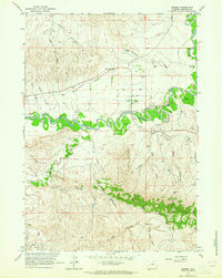
 1961 Kaycee1965 Print · USGSThe ranching country of Johnson County is meticulously detailed here in the early sixties as it centers on the community of Kaycee. Genealogists and historians can trace family landholdings like Gosney Ranch and Martirena Ranch along the banks of the Powder River.2 unique versions available
 - 1962 Map of Sheridan
 1962 Sheridan1962 Print · USGSThe Big Horn Mountains and Powder River country are captured here in the early sixties as energy production and ranching shaped northern Wyoming. Researchers can locate specific sites like the Kleenburn Coal Tipple, Eaton Bros Ranch, and the Fort McKenzie Veteran Hospital.
 - 1962 Map of Arminto
 1962 Arminto1962 Print · USGSCentral Wyoming in the early sixties reveals a landscape shaped by the Chicago and North Western railroad and early energy development. Trace the history of the region through remote outposts like Arminto, the US Naval Petroleum Reserve, and the geologic landmark at Hells Half Acre.
 - 1963 Map of Mayoworth, 1965 Print
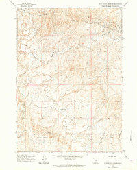
 1963 Mayoworth1965 Print · USGSJohnson County ranching and the high ridges of the Bighorn Mountains are documented here in the early sixties. Genealogists and historians can locate family outposts like Osborn Ranch and Gordon Ranch or trace the route through Dull Knife Pass.
 - 1964 Map of Dome Lake, 1968 Print
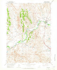
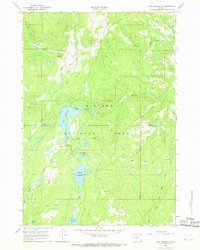
 1964 Dome Lake1968 Print · USGSThe high Bighorn Mountains are documented in the mid-1960s, showing a landscape of reservoirs, alpine lakes, and early forest service infrastructure. Researchers can trace historic access routes like the Pack Trail and locate sites like Preacher Rock and the Ranger Creek Campground.
 - 1965 Map of Park Reservoir, 1968 Print
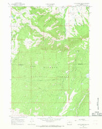
 1965 Park Reservoir1968 Print · USGSThe high Bighorn Mountains in the mid-1960s reveal a landscape of mountain resorts and sophisticated water engineering. Trace the historic Beaver Ditch and Peralta Ditch systems or locate seasonal landmarks like Spear-O-Wigwam Resort and Tepee Lodge.2 unique versions available
 - 1965 Map of Little Goose Peak, 1968 Print
 1965 Little Goose Peak1968 Print · USGSThe Bighorn Mountains in the mid-sixties are documented here along the Sheridan and Johnson county line during a period of forest management and backcountry recreation. Researchers can locate the Gen Crooks Camp, the Penrose Guard Station, and high-altitude landmarks like Little Goose Peak and Bosin Rock.2 unique versions available
 - 1966 Map of Monument Hill, 1970 Print
 1966 Monument Hill1970 Print · USGSWashakie County during the mid-sixties reveals a landscape of high-country ranching and remote mountain outposts. Researchers can locate isolated landmarks like Wilkes Cabin, the high Monument Hill, and the primitive Mazet Landing Strip in this high-altitude terrain.
Showing maps 1-25 of 55
Top cities of Johnson County
Frequently asked questions
- What are the different types of historical maps available for Johnson County?
- What is the oldest map of Johnson County?
- Where can I purchase historical maps of Johnson County for my home or office?
- Where can I download high-res historical maps of Johnson County?
- Are there historical topographic maps available for Johnson County?
- Is there historical aerial imagery available for Johnson County?
- Where are historical maps of Johnson County sourced from?