Old Maps of Johnson County, Wyoming for Academic Research
Study the evolution of Johnson County with 242 high-resolution historic maps. Whether you're teaching, researching, or modeling changes in land use, these maps provide essential visual documentation of urban, environmental, and geographic change.
- Analyze long-term change: Track patterns in development, transportation, and natural features.
- Ideal for environmental or urban studies: Support academic projects with primary historical map data.
- Use in the classroom or lab: Educators and researchers rely on these maps to bring historical context to life.
These maps are a powerful tool for teaching, research, and visualizing how Johnson County has changed over the decades.
Johnson County, WY maps
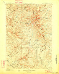
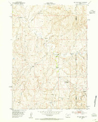
(242)- 1895 Map of Dayton
 1895 Dayton1895 Print · USGSSheridan County and the Bighorn foothills are captured here in the late nineteenth century as ranching and transit began to define the region. Genealogists and researchers can trace the early road networks connecting Dayton, Ohlman, and the ranching hub at Beckton.
 - 1899 Map of Cloud peak, 1960 Print
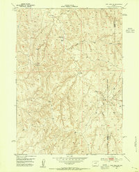
 1899 Cloud peak1960 Print · USGSThe high wilderness of the Big Horn Mountains is captured here at the end of the century, showing the remote crest and early county boundaries. Hikers and historians can trace the paths to Lake Helen, the outposts at Soldier Park, and the heights of Cloud Pk.
 - 1900 Map of Fort McKinney, 1956 Print
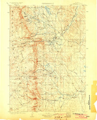
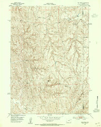
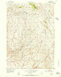
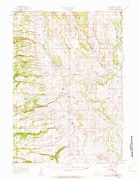
 1900 Fort McKinney1956 Print · USGSJohnson County was a landscape of military outposts and early ranching during the 1890s. Researchers can trace the layout of the Fort Mc Kinney Military Reservation or locate family sites like the T A Ranch and Hepp Ranch.
 - 1901 Map of Cloud Peak
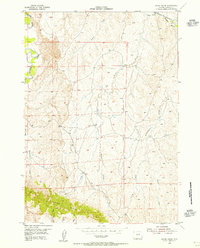
 1901 Cloud Peak1901 Print · USGSThe high alpine country of the Big Horn range is captured here at the turn of the century just after its designation as a Forest Reserve. Researchers can trace the rugged headwaters of the Powder River and find remote landmarks like Lake Solitude, Black Butte, and Cloud Peak Lake.7 unique versions available
 - 1901 Map of Dayton
 1901 Dayton1901 Print · USGSSheridan County and the Montana borderlands are captured here at the turn of the century as the railroad reshapes the valley. Researchers can trace early settlements and ranching outposts like Slack, Beckton, and the Morrow Ranch along the Tongue River.5 unique versions available
 - 1903 Map of Fort McKinney
 1903 Fort McKinney1903 Print · USGSJohnson County at the turn of the century shows a landscape transitioning from military frontier to a ranching economy. Researchers can locate early family outposts like Trabing, Greub, and the T A Ranch alongside the Fort Mc. Kinney Military Reservation.3 unique versions available
 - 1909 Map of Sheridan, 1954 Print
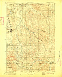
 1909 Sheridan1954 Print · USGSSheridan and the surrounding northern Wyoming ranchlands are captured here in the first decade of the twentieth century. Genealogists can trace family holdings at Wagoner Ranch or Big Red Ranch, and locate early rail stations like Verona and Ulm.2 unique versions available
 - 1911 Map of Sheridan
 1911 Sheridan1911 Print · USGSSheridan and the surrounding northern Wyoming ranchlands are captured here during a period of rapid railroad expansion. Researchers can trace the Chicago Burlington and Quincy RR through Dietz and Verona, or locate early homesteads like Wagoner Ranch.2 unique versions available
 - 1953 Map of Hoe Ranch, 1954 Print
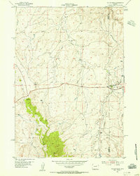
 1953 Hoe Ranch1954 Print · USGSMid-century ranching along the Powder River is preserved here as it appeared in the early fifties. Genealogists and historians can trace family-named sites such as Irigaray Ranch, Falxa Camp, and the Hoe Ranch (Historical Site).3 unique versions available
 - 1953 Map of Dry Fork Ranch, 1954 Print
 1953 Dry Fork Ranch1954 Print · USGSRanching outposts and historical trail stops define this corner of the Powder River Basin during the early 1950s. Genealogists and historians can trace old homesteads like the Dry Fork Ranch or locate the Cooks Seventeenmile Stage Station and Irvine Shearing Camp.3 unique versions available
 - 1953 Map of Fort Reno, 1954 Print
 1953 Fort Reno1954 Print · USGSThe Powder River country in the 1950s reveals a landscape where frontier history meets mid-century ranching. Trace the legacy of the Old West through the Bozeman Trail and the site of Fort Reno, alongside family holdings like Urruty Ranch.3 unique versions available
 - 1953 Map of Fort Reno SE, 1954 Print
 1953 Fort Reno SE1954 Print · USGSThe high plains of eastern Wyoming were a landscape of deep draws and artesian wells in the early fifties. Genealogists and historians can trace the remote Drew Ranch and essential water sources like First Well and the Diversion Dam along Willow Creek.4 unique versions available
 - 1953 Map of The Nipple, 1954 Print
 1953 The Nipple1954 Print · USGSThe high plains of the Powder River Basin come into focus during the early fifties, documenting a landscape of isolated ranching and mineral exploration. Genealogists and historians can trace the locations of the Dobrenz Ranch (Aban'd) and Wilson Ranch (Aban'd) near Craney Spring.2 unique versions available
 - 1954 Map of House Creek, 1956 Print
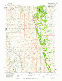
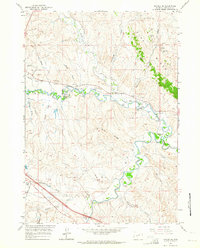
 1954 House Creek1956 Print · USGSJohnson County ranching country is captured here during the mid-1950s, showing the intersection of high-desert drainage basins and historic western migration routes. Researchers can trace the Bozeman Trail and locate family landmarks like the Windmill or the winding Powder River.3 unique versions available
 - 1954 Map of Linch, 1956 Print
 1954 Linch1956 Print · USGSJohnson County was a hub of energy production in the mid-1950s, where industrial oil camps met traditional Wyoming ranching. Researchers can trace early petroleum infrastructure at the Sussex Oil Field or locate family sites like Tillman Ranch and the Irvine Cow Camp.3 unique versions available
 - 1954 Map of Taylor Ranch, 1956 Print
 1954 Taylor Ranch1956 Print · USGSThe Johnson County high plains are captured here in the mid-fifties, dominated by the historic route of the Bozeman Trail. Researchers can trace the ranching life of the era through sites like the Taylor Sch, the U T Ranch, and the Tom R Carr Scout Camp.2 unique versions available
 - 1955 Map of Sheridan, 1973 Print
 1955 Sheridan1973 Print · USGSThe Bighorn Mountains meet the Powder River Basin in the 1950s, a period when cattle ranching and coal mining defined the regional economy. Genealogists and historians can trace local landmarks like the Fort Mackenzie Veteran Hospital, the Monarch Coal Mine, and legacy operations such as the Beckton Stock Farm.2 unique versions available
 - 1955 Map of Arminto, 1976 Print
 1955 Arminto1976 Print · USGSCentral Wyoming at the mid-century shows a landscape of energy reserves and high-plains ranching. Genealogists and historians can trace the Burlington Northern line through Lost Cabin and the famed Teapot Dome Naval Petroleum Reserve No 3.2 unique versions available
 - 1958 Map of Sheridan
 1958 Sheridan1958 Print · USGSThe Bighorn Mountains meet the high plains in the mid-1950s, revealing a landscape of large-scale ranching and mineral extraction. Trace the legacy of early settlements and industry through the Kleenburn Coal Tipple, Beckton Stock Farm, and the Hidden Dome Oil & Gas Field.2 unique versions available
 - 1958 Map of Arminto
 1958 Arminto1958 Print · USGSCentral Wyoming in the late fifties was a landscape of high-plains energy and remote rail outposts. Researchers can trace the Chicago Burlington and Quincy railroad through towns like Arminto and Waltman or locate landmarks like Teapot Rock.
 - 1959 Map of Edgerton, 1962 Print
 1959 Edgerton1962 Print · USGSHigh plains oil production and ranching define this Wyoming landscape during the late fifties. Researchers can trace the boundaries of the Teapot Dome Naval Petroleum Reserve No 3 and locate sites like Parsons Ranch and the Sawmill near Pine Ridge.
 - 1960 Map of Shell Lake, 1962 Print
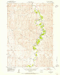
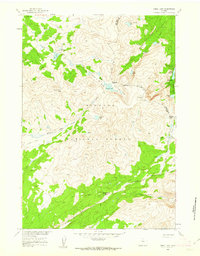 1960 Shell Lake1962 Print · USGSBighorn National Forest in the early sixties remained a backcountry expanse accessible primarily by pack trails and mountain passes. Trace the old routes through Dutch Oven Pass and locate remote landmarks like the Lake Geneva Campground and Teepee Pole Flats.4 unique versions available
 - 1961 Map of Barnum, 1962 Print
 1961 Barnum1962 Print · USGSThe ranchlands of Johnson County come to life in this early 1960s survey of the iconic Powder River country. Genealogists and historians can trace the foundations of local legacy through sites like the Roy Rinker Homestead, Grave Ranch, and the legendary Outlaw Cave.2 unique versions available
 - 1961 Map of Soldier Creek, 1964 Print
 1961 Soldier Creek1964 Print · USGSJohnson County is shown during the early sixties, where the historic Bozeman Trail traverses a landscape of deep draws and river bends. Local historians can trace the bounds of the Fort Reno Military Reservation and locate old water sources like Palmer Reservoir and Reno Reservoir.
 - 1961 Map of Kaycee NE, 1964 Print
 1961 Kaycee NE1964 Print · USGSJohnson County's ranching and mining heartland is captured here in the early sixties, centered on the Middle Fork Powder River valley. Genealogists and local historians can locate several family operations like Smith Ranch and trace numerous historic mines including the Bybee Mines and Running Mine.3 unique versions available
Showing maps 1-25 of 242
Top cities of Johnson County
Frequently asked questions
- What are the different types of historical maps available for Johnson County?
- What is the oldest map of Johnson County?
- Where can I purchase historical maps of Johnson County for my home or office?
- Where can I download high-res historical maps of Johnson County?
- Are there historical topographic maps available for Johnson County?
- Is there historical aerial imagery available for Johnson County?
- Where are historical maps of Johnson County sourced from?