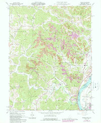
1960 Map of Addison
USGS Topo · Published 1989About this map
The Ohio River shoreline defines the eastern edge of this landscape, where the town of Addison and the community of Bellmeade sit across from the West Virginia border. The interior is characterized by the winding valleys of Campaign Creek and Kyger Creek, which cut through a dissected plateau marked by Kyger Ridge and Poplar Ridge. Heavy industry is evident along the riverfront, most notably the Power Plant and its associated Tailings Pond and industrial Conveyor, while extensive Strip Mines are visible further inland near Stingy Run.
Find a feature on this map
60 named features on this map. Tap any name to fly to it.
Don’t see what you’re looking for? This feature index may not catch every label — zoom into the map to look around manually.
Map Details
Editions of this 1960 Addison Map
4 editions found
Other maps of this area

1905 · Wilkesville
USGS Topo · 1:62,500

1906 · Bidwell
USGS Topo · 1:62,500

1907 · Pomeroy
USGS Topo · 1:62,500

1908 · Bidwell
USGS Topo · 1:62,500

1908 · Point Pleasant
USGS Topo · 1:62,500

1908 · Wilkesville
USGS Topo · 1:62,500

1926 · Point Pleasant
USGS Topo · 1:62,500

1929 · Point Pleasant
USGS Topo · 1:62,500

1947 · Columbus
USGS Topo · 1:250,000

1957 · Beech Hill
USGS Topo · 1:24,000