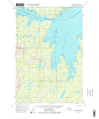
1952 Map of Afognak B-2
USGS Topo · Published 1977About this map
Port William and its adjacent Port William Seaplane Base serve as the primary human touchpoints in this coastal landscape, situated along the southern shore of Shuyak Island. The map illustrates a complex network of maritime passages and sheltered coves, defined by the narrow Shuyak Strait and the churning waters of Cape Current Narrows. Small outposts like Port Lawrence and Daylight Hbr highlight the era's reliance on seaplane and vessel transport for navigating the Kodiak Archipelago.
Find a feature on this map
28 named features on this map. Tap any name to fly to it.
Don’t see what you’re looking for? This feature index may not catch every label — zoom into the map to look around manually.
Map Details
Editions of this 1952 Afognak B-2 Map
3 editions found
Other maps of this area

1952 · Afognak
USGS Topo · 1:250,000

1952 · Afognak C-1 and C-2
USGS Topo · 1:63,360

1952 · Afognak A-3
USGS Topo · 1:63,360

1952 · Afognak A-1
USGS Topo · 1:63,360

1952 · Afognak A-2
USGS Topo · 1:63,360
1952 · Afognak C-2 and C-3
USGS Topo · 1:63,360

1952 · Afognak B-2
USGS Topo · 1:63,360

1952 · Afognak B-1
USGS Topo · 1:63,360
1953 · Afognak A-1
USGS Topo · 1:63,360

1954 · Afognak B-3
USGS Topo · 1:63,360