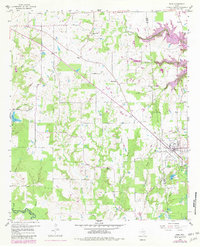
1958 Map of Alba
USGS Topo · Published 1982About this map
The town of Alba serves as the focal point of this East Texas survey, which captures the landscape at the intersection of Wood, Rains, and Van Zandt counties. Coal mining and petroleum history are evident throughout the quadrangle, with an Old Mining Area situated southeast of town and several Oil Wells dotting the rural countryside. The mapping reflects a significant transition in local geography, specifically the development of the Lake Fork Reservoir along Mustang Creek, with purple revisions indicating areas of future submersion.
Find a feature on this map
39 named features on this map. Tap any name to fly to it.
Don’t see what you’re looking for? This feature index may not catch every label — zoom into the map to look around manually.
Map Details
Editions of this 1958 Alba Map
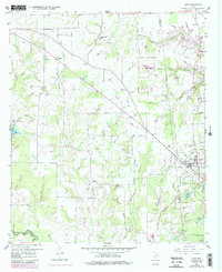
3 editions found
Other maps of this area

1956 · Tyler
USGS Topo · 1:250,000

1956 · Emory
USGS Topo · 1:62,500

1958 · Arbala
USGS Topo · 1:24,000

1958 · Alba
USGS Topo · 1:24,000

1959 · Calvary
USGS Topo · 1:24,000

1959 · Golden
USGS Topo · 1:24,000

1959 · Grand Saline
USGS Topo · 1:24,000

1959 · Yantis
USGS Topo · 1:24,000

1959 · Grand Saline
USGS Topo · 1:62,500

1959 · Alba
USGS Topo · 1:62,500