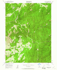
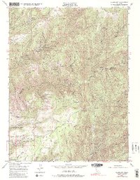
1949 Map of Alleghany
USGS Topo · Published 1961About this map
Alleghany serves as the primary hub for a landscape defined by intensive gold mining and timbered slopes within the Tahoe National Forest. By the late 1940s, this area of the Sierra Nevada shows a transition from active operations like the Oriental Mine and Plumbago Mine to numerous sites marked inactive, such as the Eldorado Mine and Morning Glory Mine. The map is particularly valuable for documenting former settlements along the Middle Yuba River and its tributaries, now recorded only as historical footprints. Notable among these are Minnesota Flat, Orleans Flat, and Moores Flat, which appear as cleared flats alongside a network of ravines and ridges. The presence of the Cem near the main townsite and isolated structures like the American Hill Cabin provides specific points of interest for genealogists tracing local families and early mountain settlers.
Find a feature on this map
117 named features on this map. Tap any name to fly to it.
Don’t see what you’re looking for? This feature index may not catch every label — zoom into the map to look around manually.
Map Details
Editions of this 1949 Alleghany Map
5 editions found
Other maps of this area

1891 · Downieville
USGS Topo · 1:125,000

1891 · Colfax
USGS Topo · 1:125,000

1892 · Colfax
USGS Topo · 1:125,000

1893 · Downieville
USGS Topo · 1:125,000

1894 · Colfax
USGS Topo · 1:125,000

1895 · Downieville
USGS Topo · 1:125,000

1896 · Downieville
USGS Topo · 1:125,000

1897 · Downieville
USGS Topo · 1:125,000

1898 · Colfax
USGS Topo · 1:125,000

1900 · Colfax
USGS Topo · 1:125,000