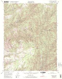
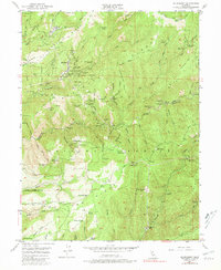
1949 Map of Alleghany
USGS Topo · Published 1981About this map
The settlement of Alleghany serves as the focal point for this 1949 survey, which captures the Sierra Nevada gold country as the era of large-scale hard-rock mining was transitioning. The map details a landscape carved by the Middle Fork Yuba River and the rugged divide between the Tahoe National Forest and Plumas National Forest. Local history is deeply embedded in the numerous "flat" sites, including Chips Flat, Minnesota Flat, and Orleans Flat, which indicate the locations of earlier hydraulic or placer mining camps.
Find a feature on this map
65 named features on this map. Tap any name to fly to it.
Don’t see what you’re looking for? This feature index may not catch every label — zoom into the map to look around manually.
Map Details
Editions of this 1949 Alleghany Map
5 editions found
Other maps of this area

1891 · Downieville
USGS Topo · 1:125,000

1891 · Colfax
USGS Topo · 1:125,000

1892 · Colfax
USGS Topo · 1:125,000

1893 · Downieville
USGS Topo · 1:125,000

1894 · Colfax
USGS Topo · 1:125,000

1895 · Downieville
USGS Topo · 1:125,000

1896 · Downieville
USGS Topo · 1:125,000

1897 · Downieville
USGS Topo · 1:125,000

1898 · Colfax
USGS Topo · 1:125,000

1900 · Colfax
USGS Topo · 1:125,000