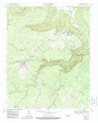
1956 Map of Altamont
USGS Topo · Published 1987About this map
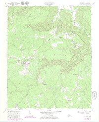
Cumberland Plateau geography defines this portion of Grundy County, where deep incisions like Savage Cove and Pepper Hollow drop away from the flat-topped highlands. The map documents the high-altitude resort character of Beersheba Springs and the administrative center at Altamont, connected by a network of winding roads and the historic Old Chattanooga Stage Road. This landscape reflects a mix of traditional mountain agriculture, early recreational retreats, and industrial extraction, evidenced by Strip Mines in the south and various family-named landmarks like Walker Cem and Killians Chapel. The dramatic geology is anchored by the Stone Door formation, overlooking the expansive South Cumberland Recreation Area. These 1987 revisions, based on 1950s data, trace the evolution of rural communities such as Gruetli-Laager and the development of local infrastructure including the Cumberland Heights Clinic.
Find a feature on this map
43 named features on this map. Tap any name to fly to it.
Don’t see what you’re looking for? This feature index may not catch every label — zoom into the map to look around manually.
Map Details
Editions of this 1956 Altamont Map
6 editions found
Other maps of this area

1893 · Mc Minnville
USGS Topo · 1:125,000

1895 · Mc Minnville
USGS Topo · 1:125,000

1895 · Sewanee
USGS Topo · 1:125,000

1936 · Palmer
USGS Topo · 1:24,000

1936 · Burrow Cove
USGS Topo · 1:24,000

1936 · Tracy City
USGS Topo · 1:24,000

1936 · Cane Hollow
USGS Topo · 1:24,000

1943 · Mc Minnville
USGS Topo · 1:100,000
1947 · Burrow Cove
USGS Topo · 1:24,000
1947 · Tracy City
USGS Topo · 1:24,000