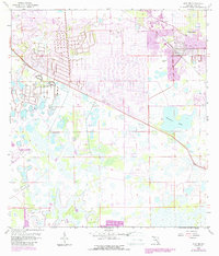
1958 Map of Alva SW
USGS Topo · Published 1987About this map
The growing residential footprint of Lehigh Acres dominates the northern half of this Lee County landscape, showcasing the planned expansion of suburban Florida in the mid-1980s. While many areas remain defined by drainage networks and wetlands, the presence of the Southwest Florida Regional Airport in the southwest corner signals the region's increasing connectivity and infrastructure.
Find a feature on this map
8 named features on this map. Tap any name to fly to it.
Don’t see what you’re looking for? This feature index may not catch every label — zoom into the map to look around manually.
Map Details
Editions of this 1958 Alva SW Map
5 editions found
Other maps of this area

1956 · West Palm Beach
USGS Topo · 1:250,000

1957 · West Palm Beach
USGS Topo · 1:250,000

1958 · West Palm Beach
USGS Topo · 1:250,000

1958 · Corkscrew NW
USGS Topo · 1:24,000

1958 · Estero
USGS Topo · 1:24,000

1958 · Olga
USGS Topo · 1:24,000

1958 · Alva SW
USGS Topo · 1:24,000

1958 · Fort Myers
USGS Topo · 1:24,000

1958 · Alva
USGS Topo · 1:24,000

1958 · Alva SE
USGS Topo · 1:24,000