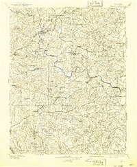
1897 Map of Amelia
USGS Topo · Published 1942About this map
The Appomattox River winds through this Central Virginia landscape, serving as a primary geographical boundary between several counties at the end of the nineteenth century. This era of settlement is defined by small crossroads communities and rural industry, with numerous water-powered sites such as Giles Mill and Belmont Mill positioned along the extensive creek networks of Deep Creek and Namozine Creek. The map documents a transition in transportation, showing the established Southern Ry and Norfolk and Western Ry intersecting with older thoroughfares like the Richmond and Lynchburg Road. Local commerce is anchored at rural hubs including Mosley Junction, Horner Store, and Rudy Store, providing a detailed look at the social and economic infrastructure of Amelia and the surrounding Dinwiddie and Chesterfield regions before the expansion of modern highways.
Find a feature on this map
114 named features on this map. Tap any name to fly to it.
Don’t see what you’re looking for? This feature index may not catch every label — zoom into the map to look around manually.
Map Details
Editions of this 1897 Amelia Map
5 editions found

Other maps of this area

1890 · Goochland
USGS Topo · 1:125,000

1891 · Palmyra
USGS Topo · 1:125,000

1891 · Farmville
USGS Topo · 1:125,000

1892 · Goochland
USGS Topo · 1:125,000

1893 · Farmville
USGS Topo · 1:125,000

1894 · Bermuda Hundred
USGS Topo · 1:62,500

1894 · Petersburg
USGS Topo · 1:62,500

1894 · Richmond
USGS Topo · 1:62,500

1895 · Richmond
USGS Topo · 1:62,500

1895 · Palmyra
USGS Topo · 1:125,000