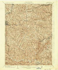
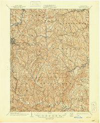
1904 Map of Amity
USGS Topo · Published 1937About this map
Washington and its surrounding townships define this early 20th-century landscape, where the transition from agricultural life to industrial expansion is clearly visible. The region is heavily bisected by vital transportation arteries, including the historic National Road and the Pittsburgh and Washington Turnpike. These routes, along with the Baltimore and Ohio RR and Pennsylvania RR, reflect the intense movement of goods and people through Washington County during this era of growth.
Find a feature on this map
88 named features on this map. Tap any name to fly to it.
Don’t see what you’re looking for? This feature index may not catch every label — zoom into the map to look around manually.
Map Details
Editions of this 1904 Amity Map
6 editions found
Other maps of this area

1900 · Masontown
USGS Topo · 1:62,500

1901 · Amity
USGS Topo · 1:62,500

1901 · Waynesburg
USGS Topo · 1:62,500

1902 · Brownsville
USGS Topo · 1:62,500

1903 · Masontown
USGS Topo · 1:62,500

1904 · Amity
USGS Topo · 1:62,500

1904 · Mc Keesport
USGS Topo · 1:62,500

1904 · Waynesburg
USGS Topo · 1:62,500

1904 · Carnegie
USGS Topo · 1:62,500

1904 · Burgettstown
USGS Topo · 1:62,500
Featured Places
- Washington, PA
- South Strabane Township, PA
- Mount Pleasant, South Strabane Township
- McGovern, Chartiers Township
- Bentleyville, PA