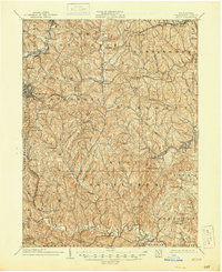
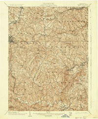
1904 Map of Amity
USGS Topo · Published 1944About this map
Washington anchors this corner of southwestern Pennsylvania, serving as a hub for the early 20th-century transportation network that defined the region. The National Pike cuts through the landscape, a primary artery of westward travel since the early 19th century, while the tracks of the Baltimore and Ohio Railroad and the Pennsylvania Railroad demonstrate the industrial evolution of the county. The map illustrates a rural landscape transitioning into an industrial powerhouse, with numerous small settlements and family landmarks such as Judge Chambers and Mt Wheeler dotting the ridges between the deep valleys of Chartiers Creek and Tenmile Creek.
Find a feature on this map
94 named features on this map. Tap any name to fly to it.
Don’t see what you’re looking for? This feature index may not catch every label — zoom into the map to look around manually.
Map Details
Editions of this 1904 Amity Map
6 editions found
Other maps of this area

1900 · Masontown
USGS Topo · 1:62,500

1901 · Amity
USGS Topo · 1:62,500

1901 · Waynesburg
USGS Topo · 1:62,500

1902 · Brownsville
USGS Topo · 1:62,500

1903 · Masontown
USGS Topo · 1:62,500

1904 · Amity
USGS Topo · 1:62,500

1904 · Mc Keesport
USGS Topo · 1:62,500

1904 · Waynesburg
USGS Topo · 1:62,500

1904 · Carnegie
USGS Topo · 1:62,500

1904 · Burgettstown
USGS Topo · 1:62,500
Featured Places
- Washington, PA
- South Strabane Township, PA
- Mount Pleasant, South Strabane Township
- McGovern, Chartiers Township
- Bentleyville, PA