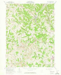
1960 Map of Amsterdam
USGS Topo · Published 1973About this map
Amsterdam stands as a primary focal point at the junction of Yellow Creek and Cox Creek, where the local landscape is defined by a dense network of ridges and narrow valleys. The region shows an intensive history of resource extraction, with numerous Strip Mines and a Strip Mine scarring the hillsides, particularly around Apex and Germano. The Penn Central railroad winds through the terrain, serving the industrial needs of the day and connecting small settlements like Swanson and Wolf Run to the broader regional economy. Genealogical interest is high here, with several family-named burial sites such as Mizer Cem, Miller Cem, and Davidson Cem scattered among the uplands. The presence of St Josephs Sch and churches near the larger villages indicates a community structure established amidst the coal and agricultural lands of the Old Seven Ranges.
Find a feature on this map
50 named features on this map. Tap any name to fly to it.
Don’t see what you’re looking for? This feature index may not catch every label — zoom into the map to look around manually.
Map Details
Editions of this 1960 Amsterdam Map
Other maps of this area

1901 · Cadiz
USGS Topo · 1:62,500

1902 · Scio
USGS Topo · 1:62,500

1903 · Cadiz
USGS Topo · 1:62,500

1904 · Scio
USGS Topo · 1:62,500

1905 · Salineville
USGS Topo · 1:62,500

1910 · Carrollton
USGS Topo · 1:62,500

1912 · Carrollton
USGS Topo · 1:62,500

1951 · Canton
USGS Topo · 1:250,000

1953 · Canton
USGS Topo · 1:250,000

1957 · Canton
USGS Topo · 1:250,000