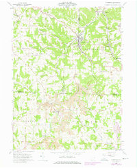
1960 Map of Amsterdam
USGS Topo · Published 1978About this map
Amsterdam stands as a central settlement in the upper reaches of the Yellow Creek valley, where the Penn Central railroad cuts through the broken hills of Loudon and Springfield townships. This 1960 survey highlights a landscape heavily shaped by industrial activity, with extensive Strip Mines and several smaller Strip Mine operations flanking the ridges around Apex and Germano. The presence of numerous family and rural burial grounds, such as Simmons Ridge Cem, Mizer Cem, and Buffalo Hill Cem, provides a detailed record for genealogists tracking local lineages in this corner of Jefferson, Carroll, and Harrison Counties.
Find a feature on this map
46 named features on this map. Tap any name to fly to it.
Don’t see what you’re looking for? This feature index may not catch every label — zoom into the map to look around manually.
Map Details
Editions of this 1960 Amsterdam Map
Other maps of this area

1901 · Cadiz
USGS Topo · 1:62,500

1902 · Scio
USGS Topo · 1:62,500

1903 · Cadiz
USGS Topo · 1:62,500

1904 · Scio
USGS Topo · 1:62,500

1905 · Salineville
USGS Topo · 1:62,500

1910 · Carrollton
USGS Topo · 1:62,500

1912 · Carrollton
USGS Topo · 1:62,500

1951 · Canton
USGS Topo · 1:250,000

1953 · Canton
USGS Topo · 1:250,000

1957 · Canton
USGS Topo · 1:250,000