
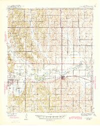
1945 Map of Anadarko
USGS Topo · Published 1945About this map
The Washita River snakes through the heart of Caddo and Grady counties, defining a landscape shaped by the Chicago Rock Island and Pacific railroad and a dense network of rural community centers. Near the river, Anadarko and Verden serve as primary hubs, with the Kiowa Indian Agency and Riverside Indian School marking the significant administrative and educational presence of the region's tribal heritage. Beyond the towns, the map reveals a meticulously organized countryside where nearly every township section is anchored by a local school or church.
Find a feature on this map
51 named features on this map. Tap any name to fly to it.
Don’t see what you’re looking for? This feature index may not catch every label — zoom into the map to look around manually.
Map Details
Editions of this 1945 Anadarko Map
2 editions found
Other maps of this area

1893 · Buggy Creek
USGS Topo · 1:62,500

1893 · Minco
USGS Topo · 1:62,500

1902 · Rush Springs
USGS Topo · 1:125,000

1904 · Chickasha
USGS Topo · 1:125,000

1949 · Cement
USGS Topo · 1:62,500

1949 · Rush Springs
USGS Topo · 1:62,500

1950 · Rush Springs
USGS Topo · 1:62,500

1951 · Binger
USGS Topo · 1:62,500

1951 · Fort Cobb
USGS Topo · 1:62,500

1954 · Oklahoma City
USGS Topo · 1:250,000