Loading...
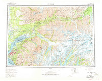
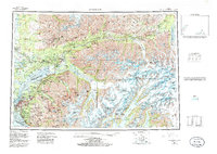
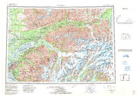
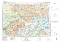
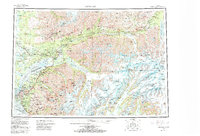
Loading map...1962 Map of Anchorage
USGS Topo · Published 1969About this map
The growing city of Anchorage and the adjacent community of Spenard dominate the coast of Cook Inlet in this mid-century survey. Military installations at Elmendorf Air Force Base and Fort Richardson define the northern edge of the urban area, while the Alaska Railroad and the Glenn Highway establish the primary corridors for transport and settlement.
Find a feature on this map
168 named features on this map. Tap any name to fly to it.
Don’t see what you’re looking for? This feature index may not catch every label — zoom into the map to look around manually.
Map Details
Date Portrayed1962
Date Published1969
PublisherU.S. Geological Survey
Map TypeTopographic
Scale1:250,000
Physical Dimensions30.4 x 24.2 inches
Editions of this 1962 Anchorage Map
6 editions found

Historical Maps of Anchorage Through Time
3 maps found

Featured Locations
Source Details
SourceU.S. Geological Survey
CopyrightPublic Domain