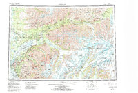
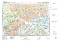
1962 Map of Anchorage
USGS Topo · Published 1986About this map
The Alaska Railroad and the Glenn Highway serve as the primary conduits through this expansive Alaskan landscape, connecting the growing hub of Anchorage to the outlying valleys and mountain ranges. The map details the transition from the coastal military installations of Elmendorf Air Force Base and Fort Richardson Military Reservation to the developing settlements of Wasilla, Palmer, and Chugiak. In the north, the industrial history of the region is anchored by the Independence Mine State Historical Park and the coal-rich areas near Jonesville and Eska. To the east, the topography is dominated by massive ice fields and tidal waters, including the Columbia Glacier and College Fiord. This survey provides a rare look at the glaciology of the Chugach Mountains before major modern recessions, documenting the reach of the Matanuska Glacier and Harvard Glacier as they appeared in the mid-20th century.
Find a feature on this map
81 named features on this map. Tap any name to fly to it.
Don’t see what you’re looking for? This feature index may not catch every label — zoom into the map to look around manually.
Map Details
Editions of this 1962 Anchorage Map
6 editions found

Other maps of this area

1944 · Kenai
USGS Topo · 1:250,000

1948 · Cordova
USGS Topo · 1:250,000

1948 · Anchorage D-3
USGS Topo · 1:63,360

1948 · Anchorage D-2
USGS Topo · 1:63,360

1948 · Anchorage D-4
USGS Topo · 1:63,360

1948 · Anchorage D-1
USGS Topo · 1:63,360

1949 · Tyonek
USGS Topo · 1:250,000

1949 · Anchorage D-5
USGS Topo · 1:63,360

1949 · Anchorage D-7
USGS Topo · 1:63,360

1949 · Talkeetna Mountains A-1
USGS Topo · 1:63,360