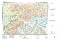
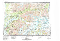
1962 Map of Anchorage
USGS Topo · Published 1986About this map
Anchorage serves as the focal point of this mid-century landscape, where the convergence of the Knik Arm and Turnagain Arm meets the rising peaks of the Chugach Mountains. The transportation network of the era is clearly defined, with the Alaska Railroad and the Glenn Highway threading through the Matanuska River valley toward settlements like Palmer and Wasilla. To the north, the industrial legacy of the region is marked by Independence Mine State Historical Park in the Talkeetna Mountains. The map reveals a post-war military footprint with the sprawling Elmendorf Air Force Base and Fort Richardson Military Reservation bordering the city. Beyond the developing hubs, the terrain is dominated by massive glacial systems such as those feeding into College Fiord and Harriman Fiord, illustrating the transition from urban expansion to the formidable Alaskan wilderness.
Find a feature on this map
65 named features on this map. Tap any name to fly to it.
Don’t see what you’re looking for? This feature index may not catch every label — zoom into the map to look around manually.
Map Details
Editions of this 1962 Anchorage Map
6 editions found

Other maps of this area

1944 · Kenai
USGS Topo · 1:250,000

1948 · Cordova
USGS Topo · 1:250,000

1948 · Anchorage D-3
USGS Topo · 1:63,360

1948 · Anchorage D-2
USGS Topo · 1:63,360

1948 · Anchorage D-4
USGS Topo · 1:63,360

1948 · Anchorage D-1
USGS Topo · 1:63,360

1949 · Tyonek
USGS Topo · 1:250,000

1949 · Anchorage D-5
USGS Topo · 1:63,360

1949 · Anchorage D-7
USGS Topo · 1:63,360

1949 · Talkeetna Mountains A-1
USGS Topo · 1:63,360