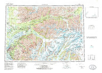
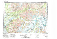
1962 Map of Anchorage
USGS Topo · Published 1985About this map
The Anchorage area and the sprawling Cook Inlet coastline are documented here in a 1985 revision that highlights the intersection of military infrastructure and the surrounding wilderness. Both Elmendorf Air Force Base and Fort Richardson dominate the landscape just north of the city center, while the Alaska Railroad and Glenn Highway provide the primary transit corridors through Chugiak and Eagle River. To the north, the Matanuska-Susitna Borough includes growing settlements like Wasilla and Palmer, set against the agricultural backdrop of the Matanuska River valley.
Find a feature on this map
47 named features on this map. Tap any name to fly to it.
Don’t see what you’re looking for? This feature index may not catch every label — zoom into the map to look around manually.
Map Details
Editions of this 1962 Anchorage Map
6 editions found

Other maps of this area

1944 · Kenai
USGS Topo · 1:250,000

1948 · Cordova
USGS Topo · 1:250,000

1948 · Anchorage D-3
USGS Topo · 1:63,360

1948 · Anchorage D-2
USGS Topo · 1:63,360

1948 · Anchorage D-4
USGS Topo · 1:63,360

1948 · Anchorage D-1
USGS Topo · 1:63,360

1949 · Tyonek
USGS Topo · 1:250,000

1949 · Anchorage D-5
USGS Topo · 1:63,360

1949 · Anchorage D-7
USGS Topo · 1:63,360

1949 · Talkeetna Mountains A-1
USGS Topo · 1:63,360