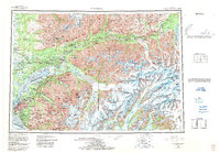
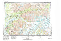
1962 Map of Anchorage
USGS Topo · Published 1986About this map
Anchorage and its surrounding wilderness are shown here in the early 1960s, a period of transition for the region's transport and industry. The Alaska Railroad and Glenn Highway serve as the primary conduits for commerce, connecting the urban center to outlying coal and gold mining districts like Sutton and Jonesville. Further north, the Independence Mine State Historical Park and the Premier Mine reflect the area’s extractive heritage near the Talkeetna Mountains.
Find a feature on this map
106 named features on this map. Tap any name to fly to it.
Don’t see what you’re looking for? This feature index may not catch every label — zoom into the map to look around manually.
Map Details
Editions of this 1962 Anchorage Map
6 editions found

Other maps of this area

1944 · Kenai
USGS Topo · 1:250,000

1948 · Cordova
USGS Topo · 1:250,000

1948 · Anchorage D-3
USGS Topo · 1:63,360

1948 · Anchorage D-2
USGS Topo · 1:63,360

1948 · Anchorage D-4
USGS Topo · 1:63,360

1948 · Anchorage D-1
USGS Topo · 1:63,360

1949 · Tyonek
USGS Topo · 1:250,000

1949 · Anchorage D-5
USGS Topo · 1:63,360

1949 · Anchorage D-7
USGS Topo · 1:63,360

1949 · Talkeetna Mountains A-1
USGS Topo · 1:63,360