
1953 Map of Andalusia
USGS Topo · Published 1965About this map
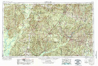
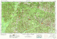
The Alabama River and Tombigbee River define the western boundaries of this Southern landscape, where the Red Hills transition into the Piney Woods. This 1950s survey, updated in the mid-1960s, reveals a region deeply shaped by its rail networks and timber resources. The Louisville & Nashville railroad serves as a central spine, connecting key timber and trading hubs like Greenville, Evergreen, and Brewton. In the southeast, the Conecuh National Forest preserves a significant portion of the pine-dominated wilderness.
Find a feature on this map
53 named features on this map. Tap any name to fly to it.
Don’t see what you’re looking for? This feature index may not catch every label — zoom into the map to look around manually.
Map Details
Editions of this 1953 Andalusia Map
Other maps of this area

1941 · Bay Minette
USGS Topo · 1:62,500

1941 · Creola
USGS Topo · 1:62,500

1941 · Century
USGS Topo · 1:62,500

1942 · Enterprise
USGS Topo · 1:125,000

1942 · Perdido
USGS Topo · 1:62,500

1942 · Dyas
USGS Topo · 1:62,500

1943 · Creola
USGS Topo · 1:62,500

1943 · Century
USGS Topo · 1:62,500

1943 · Bay Minette
USGS Topo · 1:62,500

1943 · Jay
USGS Topo · 1:62,500