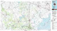
1984 Map of Angleton
USGS Topo · Published 1984About this map
The Brazos River and San Bernard River dominate this coastal Texas landscape, winding through a region where heavy industry and state institutions meet the wetlands of the Gulf Coast. The map reveals an extensive network of petroleum infrastructure, featuring prominent sites like the Damon Mound Oil Field and Sugar Valley Oil Field. These energy hubs are interspersed with significant landholdings for the State Department of Corrections (Retrieve Unit) and other correctional facilities, which occupy large tracts near the river bends.
Find a feature on this map
150 named features on this map. Tap any name to fly to it.
Don’t see what you’re looking for? This feature index may not catch every label — zoom into the map to look around manually.
Map Details
Editions of this 1984 Angleton Map
2 editions found
Other maps of this area

1916 · Genoa
USGS Topo · 1:24,000

1916 · Seabrook
USGS Topo · 1:24,000

1920 · Seabrook
USGS Topo · 1:31,680

1920 · Genoa
USGS Topo · 1:31,680

1920 · Mykawa
USGS Topo · 1:31,680

1920 · Almeda
USGS Topo · 1:31,680

1929 · Dickinson
USGS Topo · 1:24,000

1929 · Karankawa Lake
USGS Topo · 1:24,000

1929 · Algoa
USGS Topo · 1:24,000

1929 · Hitchcock
USGS Topo · 1:24,000