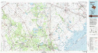
1984 Map of Angleton
USGS Topo · Published 2009About this map
The Brazos River and San Bernard River dominate this coastal Texas landscape, carving through a region defined by industrial water management and natural wetlands in the early 1980s. Significant infrastructure projects like the Harris Reservoir and Brazoria Reservoir appear alongside established settlements such as Angleton, Lake Jackson, and West Columbia. The terrain is punctuated by distinctive geological features, notably the salt dome formations at Damon Mound and Hoskins Mound, which stand out against the low-lying coastal plains and marshes near San Luis Pass.
Find a feature on this map
114 named features on this map. Tap any name to fly to it.
Don’t see what you’re looking for? This feature index may not catch every label — zoom into the map to look around manually.
Map Details
Editions of this 1984 Angleton Map
2 editions found
Other maps of this area

1916 · Genoa
USGS Topo · 1:24,000

1916 · Seabrook
USGS Topo · 1:24,000

1920 · Seabrook
USGS Topo · 1:31,680

1920 · Genoa
USGS Topo · 1:31,680

1920 · Mykawa
USGS Topo · 1:31,680

1920 · Almeda
USGS Topo · 1:31,680

1929 · Dickinson
USGS Topo · 1:24,000

1929 · Karankawa Lake
USGS Topo · 1:24,000

1929 · Algoa
USGS Topo · 1:24,000

1929 · Hitchcock
USGS Topo · 1:24,000