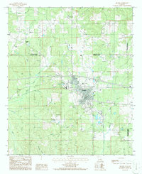
1986 Map of Arcadia
USGS Topo · Published 1986About this map
Arcadia serves as the central hub of this North Louisiana landscape, situated where the terrain begins to slope toward the drainage basins of Bayou Saline and Boggy Branch. The settlement pattern in the mid-1980s reveals a mix of traditional agriculture and modern infrastructure, evidenced by the presence of the Arcadia-Bienville Airport and a significant Gas Storage Area.
Find a feature on this map
27 named features on this map. Tap any name to fly to it.
Don’t see what you’re looking for? This feature index may not catch every label — zoom into the map to look around manually.
Map Details
Editions of this 1986 Arcadia Map
This is the sole edition of this map. No revisions or reprints were ever made.
Other maps of this area

1947 · Bienville
USGS Topo · 1:62,500

1948 · Jamestown
USGS Topo · 1:62,500

1949 · Jamestown
USGS Topo · 1:62,500

1949 · Bienville
USGS Topo · 1:62,500

1949 · Gibsland
USGS Topo · 1:62,500

1950 · Gibsland
USGS Topo · 1:62,500

1950 · Arcadia
USGS Topo · 1:62,500

1951 · Arcadia
USGS Topo · 1:62,500

1955 · Shreveport
USGS Topo · 1:250,000

1956 · Shreveport
USGS Topo · 1:250,000