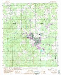
1994 Map of Arcadia
USGS Topo · Published 1995About this map
Arcadia serves as the focal point of this North Louisiana landscape, where the municipal grid is surrounded by a complex network of waterways and industrial features. This 1994 revision highlights the intersection of transportation and infrastructure, from the Arcadia-Bienville Airport south of town to the extensive Gas Storage Area near Saline Bayou. The terrain is defined by its many drainage systems, including Sugar Creek, Brinsons Creek, and Boggy Branch, which weave between small rural settlements like Frazier and Hurricane.
Find a feature on this map
25 named features on this map. Tap any name to fly to it.
Don’t see what you’re looking for? This feature index may not catch every label — zoom into the map to look around manually.
Map Details
Editions of this 1994 Arcadia Map
This is the sole edition of this map. No revisions or reprints were ever made.
Other maps of this area

1947 · Bienville
USGS Topo · 1:62,500

1948 · Jamestown
USGS Topo · 1:62,500

1949 · Jamestown
USGS Topo · 1:62,500

1949 · Bienville
USGS Topo · 1:62,500

1949 · Gibsland
USGS Topo · 1:62,500

1950 · Gibsland
USGS Topo · 1:62,500

1950 · Arcadia
USGS Topo · 1:62,500

1951 · Arcadia
USGS Topo · 1:62,500

1955 · Shreveport
USGS Topo · 1:250,000

1956 · Shreveport
USGS Topo · 1:250,000