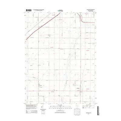
2013 Map of Arlington
USGS Topo · Published 2013About this map
Arlington and Jenera anchor this Hancock County landscape, where the flat agricultural terrain is defined by a dense grid of township roads and the slow winding of Eagle Creek and Tiderishi Cr. The map reveals a deeply rooted rural community, evidenced by numerous family and church-affiliated burial grounds such as Hartman Cem, Bishop Cem, and Saint Pauls Cem. These landmarks, along with established agricultural operations like Boehm Dairy Farm and Plain View Dairy, illustrate the enduring land-use patterns of Northwest Ohio. Modern infrastructure is represented by several small aviation strips, including Schaller Airport and Alge Airport, which sit among the fields. The confluence of Buck Run and Eagle Creek near the southeastern corner further emphasizes the importance of these small drainage systems in shaping the local geography.
Find a feature on this map
114 named features on this map. Tap any name to fly to it.
Don’t see what you’re looking for? This feature index may not catch every label — zoom into the map to look around manually.
Map Details
Editions of this 2013 Arlington Map
This is the sole edition of this map. No revisions or reprints were ever made.
Other maps of this area

1903 · Findlay
USGS Topo · 1:62,500

1905 · Arlington
USGS Topo · 1:62,500

1907 · Bluffton
USGS Topo · 1:62,500

1907 · Arlington
USGS Topo · 1:24,000

1950 · Marion
USGS Topo · 1:250,000

1956 · Toledo
USGS Topo · 1:250,000

1960 · Rawson
USGS Topo · 1:24,000

1960 · Arlington
USGS Topo · 1:24,000
1960 · Findlay
USGS Topo · 1:24,000

1960 · Mt Blanchard
USGS Topo · 1:24,000