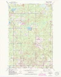
1953 Map of Arnold
USGS Topo · Published 1993About this map
Normanna and the surrounding townships of Gnesen, Rice Lake, and Lakewood define this mid-century landscape north of Duluth. The area is characterized by a dense network of water bodies, including Eagle Lake, Horseshoe Lake, and Jacobs Lake, which feed the southern-flowing Lester River and French River systems. A prominent Railroad Grade cuts across the northern section, tracing a former path of industry through the wooded terrain near Schultz Lake.
Find a feature on this map
32 named features on this map. Tap any name to fly to it.
Don’t see what you’re looking for? This feature index may not catch every label — zoom into the map to look around manually.
Map Details
Editions of this 1953 Arnold Map
5 editions found
Other maps of this area

1895 · Duluth
USGS Topo · 1:62,500

1953 · Lakewood
USGS Topo · 1:24,000

1953 · French River
USGS Topo · 1:24,000

1953 · Arnold
USGS Topo · 1:24,000

1953 · Duluth
USGS Topo · 1:24,000

1953 · Duluth Heights
USGS Topo · 1:24,000

1953 · Boulder Lake Reservoir
USGS Topo · 1:24,000

1953 · Fredenberg
USGS Topo · 1:24,000

1953 · Duluth
USGS Topo · 1:62,500

1953 · Ashland
USGS Topo · 1:250,000