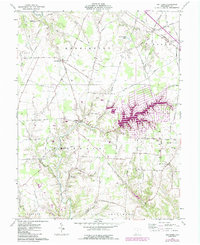
1961 Map of Ash Ridge
USGS Topo · Published 1987About this map
Waynoka Lake dominates the central landscape of this Brown County survey, showcasing the development of residential lakeside infrastructure alongside the traditional rural character of southern Ohio. The 1980s revisions in purple highlight the intricate street networks and sprawling shoreline of the lake, contrasting with the established agricultural patterns of Arnheim and Ash Ridge. This area is particularly rich for genealogical research, documenting numerous family-named landmarks and historical burial grounds such as Wardlow Cem, Bohrer Cem, and McFaddin Cem.
Find a feature on this map
44 named features on this map. Tap any name to fly to it.
Don’t see what you’re looking for? This feature index may not catch every label — zoom into the map to look around manually.
Map Details
Editions of this 1961 Ash Ridge Map
Other maps of this area

1917 · Hillsboro
USGS Topo · 1:62,500

1917 · Sardinia
USGS Topo · 1:62,500

1918 · Seaman
USGS Topo · 1:62,500

1928 · Higginsport
USGS Topo · 1:48,000

1931 · Higginsport
USGS Topo · 1:62,500

1944 · Hillsboro
USGS Topo · 1:62,500

1944 · Sardinia
USGS Topo · 1:62,500

1947 · Columbus
USGS Topo · 1:250,000

1952 · Higginsport
USGS Topo · 1:24,000

1957 · Huntington
USGS Topo · 1:250,000