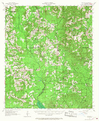
1957 Map of Ashland
USGS Topo · Published 1968About this map
Bienville, Red River, and Natchitoches Parishes converge in this mid-century landscape dominated by a network of bayous and rural timber tracts. The town of Ashland serves as a local hub along the Kansas City Southern railroad, which cuts a northwest-to-southeast path through the terrain. Evidence of the region's industrial and social evolution is visible in the scattered Oil Field operations and the transition of local institutions, including the New Hope Sch and Iron Springs Sch, both noted as abandoned by the late 1950s.
Find a feature on this map
72 named features on this map. Tap any name to fly to it.
Don’t see what you’re looking for? This feature index may not catch every label — zoom into the map to look around manually.
Map Details
Editions of this 1957 Ashland Map
3 editions found

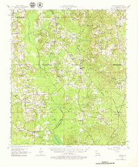
Other maps of this area

1937 · Campti NE
USGS Topo · 1:31,680

1937 · Campti NW
USGS Topo · 1:31,680

1938 · Lake End
USGS Topo · 1:31,680

1944 · Campti
USGS Topo · 1:62,500

1947 · Ringgold
USGS Topo · 1:62,500

1947 · Goldonna
USGS Topo · 1:62,500

1947 · Ashland
USGS Topo · 1:62,500

1947 · Hanna
USGS Topo · 1:62,500

1947 · Bienville
USGS Topo · 1:62,500

1948 · Coushatta
USGS Topo · 1:62,500