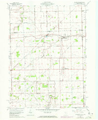
1960 Map of Assumption
USGS Topo · Published 1972About this map
Agricultural fields and drainage networks define the borderlands of Northwest Ohio and Southern Michigan on this 1960 survey. Small rural clusters like Metamora and Assumption anchor the local economy, while the Toledo and Ironton railroad cuts a diagonal path through the northern half of the quadrangle. The map reveals a landscape managed by engineering, featuring the Metamora Reservoir and an intricate system of ditches including Mc Nett Ditch and Frankfort Ditch.
Find a feature on this map
31 named features on this map. Tap any name to fly to it.
Don’t see what you’re looking for? This feature index may not catch every label — zoom into the map to look around manually.
Map Details
Editions of this 1960 Assumption Map
Other maps of this area

1911 · Wauseon
USGS Topo · 1:62,500

1911 · Swanton
USGS Topo · 1:62,500

1913 · Wauseon
USGS Topo · 1:62,500

1914 · Swanton
USGS Topo · 1:62,500

1935 · Whitehouse
USGS Topo · 1:24,000

1935 · Berkey
USGS Topo · 1:24,000

1939 · Berkey
USGS Topo · 1:31,680

1939 · Blissfield
USGS Topo · 1:62,500
1940 · Whitehouse
USGS Topo · 1:31,680

1941 · Blissfield
USGS Topo · 1:62,500