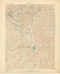
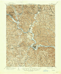
1905 Map of Athens
USGS Topo · Published 1905About this map
Athens serves as the focal point of this 1905 topograpy, situated at the confluence of the Hocking River and several smaller tributaries. The region is a dense network of industrial and transport infrastructure, reflecting the coal-driven economy of the early 20th century. Major rail lines including the Baltimore and Ohio Southwestern RR and the Hocking Valley RR converge here, linking numerous mining settlements such as Carbon Hill, Nelsonville, and Buchtel.
Find a feature on this map
79 named features on this map. Tap any name to fly to it.
Don’t see what you’re looking for? This feature index may not catch every label — zoom into the map to look around manually.
Map Details
Editions of this 1905 Athens Map
6 editions found
Other maps of this area

1903 · Athens
USGS Topo · 1:62,500

1904 · Zaleski
USGS Topo · 1:62,500

1904 · Chesterhill
USGS Topo · 1:62,500

1905 · Athens
USGS Topo · 1:62,500

1905 · Wilkesville
USGS Topo · 1:62,500

1906 · Chesterhill
USGS Topo · 1:62,500

1907 · Pomeroy
USGS Topo · 1:62,500

1907 · Keno
USGS Topo · 1:62,500

1907 · Zaleski
USGS Topo · 1:62,500

1907 · Logan
USGS Topo · 1:62,500