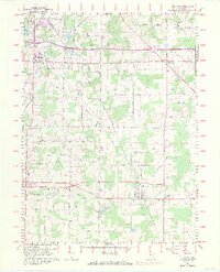
1960 Map of Atwater
USGS Topo · Published 1971About this map
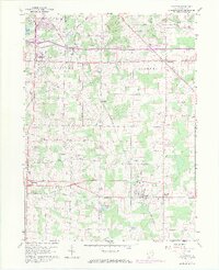
Rootstown and Edinburg anchor the northern townships of this Portage County landscape, which sits entirely within the historic boundaries of the Connecticut Western Reserve. The 1960s agricultural character is defined by a dense network of country lanes like Hattrick Road and Bassett Road, connecting small rural centers including Industry and Randolph. The Penn Central rail line cuts diagonally across the terrain, serving the station at New Milford and passing through the village of Atwater. Local history and genealogy are well-represented by numerous burial grounds, such as the Disciple Cem and Homeland Cem, alongside water features like Muzzy Lake and Schultz Lake. This survey illustrates the transition of the region before significant modern suburban expansion, preserving the location of family-named landmarks and early transportation corridors.
Find a feature on this map
55 named features on this map. Tap any name to fly to it.
Don’t see what you’re looking for? This feature index may not catch every label — zoom into the map to look around manually.
Map Details
Editions of this 1960 Atwater Map
8 editions found
Other maps of this area

1901 · Canton
USGS Topo · 1:62,500

1903 · Canton
USGS Topo · 1:62,500

1906 · Kent
USGS Topo · 1:62,500

1906 · Ravenna
USGS Topo · 1:62,500

1908 · Ravenna
USGS Topo · 1:62,500

1909 · Alliance
USGS Topo · 1:62,500

1950 · Cleveland
USGS Topo · 1:250,000

1951 · Canton
USGS Topo · 1:250,000

1952 · Alliance
USGS Topo · 1:24,000

1953 · Canton
USGS Topo · 1:250,000