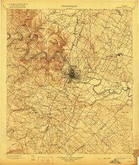
1910 Map of Austin
USGS Topo · Published 1921About this map
Austin sits at a critical geographic junction where the rugged Jollyville Plateau meets the prairie, centered on the winding path of the Colorado River. Surveyed in the late 19th century, this map documents the capital city before the massive 20th-century expansion, showing established landmarks like Saint Edwards College and the strategic Fort Magruder. The surrounding landscape is a network of small agricultural settlements and early education centers, such as Johnson's Institute and Science Hall.
Find a feature on this map
114 named features on this map. Tap any name to fly to it.
Don’t see what you’re looking for? This feature index may not catch every label — zoom into the map to look around manually.
Map Details
Editions of this 1910 Austin Map
3 editions found

Other maps of this area

1885 · Taylor
USGS Topo · 1:125,000

1885 · Bastrop
USGS Topo · 1:125,000

1887 · Taylor
USGS Topo · 1:125,000

1887 · Blanco
USGS Topo · 1:125,000

1887 · Burnet
USGS Topo · 1:125,000

1893 · Georgetown
USGS Topo · 1:125,000

1893 · Burnet
USGS Topo · 1:125,000

1893 · Bastrop
USGS Topo · 1:125,000

1894 · Blanco
USGS Topo · 1:125,000

1894 · Taylor
USGS Topo · 1:125,000