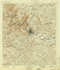
1910 Map of Austin
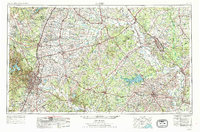
USGS Topo · Published 1943About this map
The Colorado River winds through the heart of Central Texas, its path obstructed by the City Dam and creating the early reservoir of Lake McDonald. In this late-nineteenth-century survey, the landscape reveals a transition from the rugged Jollyville Plateau and landmarks like Mt Bonnel to the emerging urban grid of Austin. Transportation at this time relied heavily on river crossings such as Cameron Ferry, Sylvester Ford, and Stones Ford. Beyond the city limits, educational and spiritual centers like Saint Edwards College, Johnsons Institute, and Friendship Church serve as vital community anchors.
Find a feature on this map
121 named features on this map. Tap any name to fly to it.
Don’t see what you’re looking for? This feature index may not catch every label — zoom into the map to look around manually.
Map Details
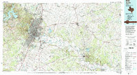
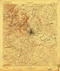
Editions of this 1910 Austin Map
3 editions found

Historical Maps of Austin Through Time
6 maps found