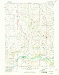
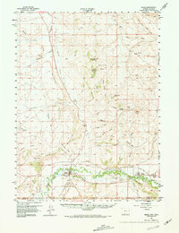
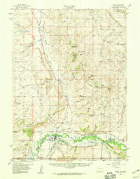
1957 Map of Baggs
USGS Topo · Published 1968About this map
The confluence of the Snake River and the Little Snake River anchors this mid-century survey of the Wyoming-Colorado border. Centered on the settlement of Baggs, the landscape is defined by extensive irrigation works including the Baggs Ditch, Side Canal, and West Side Canal, which support agriculture along the river flats beneath the prominent escarpments of The Bluffs. The map documents a rugged rangeland punctuated by family-named landmarks such as Morgan Ranch and isolated topographic features like Wild Horse Butte and Muddy Mtn. Evidence of early community life is preserved through the locations of the Baggs Cem and Eversole Cem, while an Airstrip near Weber Mesa indicates the era's increasing reliance on aerial transport for this remote high-desert terrain.
Find a feature on this map
56 named features on this map. Tap any name to fly to it.
Don’t see what you’re looking for? This feature index may not catch every label — zoom into the map to look around manually.
Map Details
Editions of this 1957 Baggs Map
3 editions found
Other maps of this area

1916 · Craig
USGS Topo · 1:125,000

1932 · Savery
USGS Topo · 1:96,000

1940 · Savery
USGS Topo · 1:125,000

1954 · Rawlins
USGS Topo · 1:250,000

1954 · Craig
USGS Topo · 1:250,000

1957 · Craig
USGS Topo · 1:250,000
1957 · Baggs
USGS Topo · 1:62,500
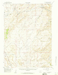
1957 · Doty Mountain
USGS Topo · 1:62,500

1958 · Rawlins
USGS Topo · 1:250,000

1958 · Craig
USGS Topo · 1:250,000