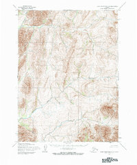
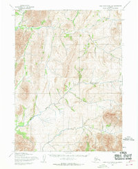
1955 Map of Baird Mountains C-6
USGS Topo · Published 1984About this map
Eli River and Agashashok River define the complex drainage patterns of this Alaskan landscape, where the Army Map Service utilized aerial photography from 1953 and 1955 to chart the topography. This mid-century survey captures a corner of the Brooks Range before modern infrastructure reached the region, showing the land as it remained under the administration of the Bureau of Land Management. The terrain is dominated by high ridges and deep river valleys, with Ahaliknak Creek feeding into the northern waterways. The absence of roads or established settlements on this sheet highlights the primary role of the river systems as the historical natural corridors through this portion of the Northwest Arctic.
Find a feature on this map
3 named features on this map. Tap any name to fly to it.
Don’t see what you’re looking for? This feature index may not catch every label — zoom into the map to look around manually.
Map Details
Editions of this 1955 Baird Mountains C-6 Map
3 editions found
Other maps of this area

1951 · Baird Mountains
USGS Topo · 1:250,000

1951 · Noatak
USGS Topo · 1:250,000

1955 · Noatak
USGS Topo · 1:250,000

1955 · Noatak D-1
USGS Topo · 1:63,360

1955 · Baird Mountains D-6
USGS Topo · 1:63,360

1955 · Baird Mountains D-5
USGS Topo · 1:63,360

1955 · Noatak C-1
USGS Topo · 1:63,360
1955 · Baird Mountains C-5
USGS Topo · 1:63,360
1955 · Baird Mountains B-6
USGS Topo · 1:63,360
1955 · Baird Mountains C-6
USGS Topo · 1:63,360