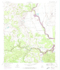
1962 Map of Baker Lake
USGS Topo · Published 1974About this map
Ferguson State Prison Farm and Eastham State Prison Farm dominate the high ground above the winding Trinity River in this detailed survey. The landscape is characterized by the transition from upland settlements like Bald Prairie and Larrison to the sprawling bottomlands of the Trinity basin. This era marks a significant hydrological shift with the arrival of Lake Livingston, shown here in its early stages of inundation. The map captures the intricate drainage network of Bedias Creek and South Bedias Creek, where numerous smaller tributaries like Pollard Branch and Black Oak Branch cut through the timbered terrain. Institutional presence and rural education are preserved through labels for the Hopewell Sch and Shaw Prairie Sch, providing critical points of reference for local historians studying the mid-century development of Madison, Houston, and Walker Counties.
Find a feature on this map
26 named features on this map. Tap any name to fly to it.
Don’t see what you’re looking for? This feature index may not catch every label — zoom into the map to look around manually.
Map Details
Editions of this 1962 Baker Lake Map
2 editions found
Other maps of this area

1953 · Palestine
USGS Topo · 1:250,000

1954 · Beaumont
USGS Topo · 1:250,000

1957 · Beaumont
USGS Topo · 1:250,000

1957 · Palestine
USGS Topo · 1:250,000

1962 · Pine Prairie
USGS Topo · 1:24,000

1962 · Connor
USGS Topo · 1:24,000

1962 · Wyser Bottom
USGS Topo · 1:24,000

1962 · Baker Lake
USGS Topo · 1:24,000

1963 · Steep Branch
USGS Topo · 1:24,000

1963 · Crabbs Prairie
USGS Topo · 1:24,000