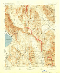
1913 Map of Ballarat
USGS Topo · Published 1947About this map
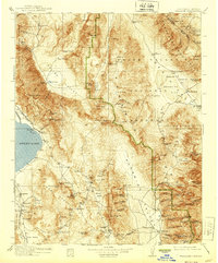
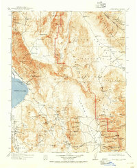
The Panamint Range and the deep troughs of the Panamint Valley and Death Valley National Monument dominate this early twentieth-century survey of the California-Nevada borderlands. The map documents an era of intense resource extraction and remote settlement, centered on the mining hubs of Ballarat and Darwin. The Cerro Gordo Mines overlook the eastern shore of Owens Lake, where a Soda Works and the Southern Pacific railroad terminal at Keeler supported the regional economy. Beyond the primary towns, the landscape is dotted with isolated outposts like Skidoo, Harrisburg, and Hungry Bills Ranch. The presence of numerous water sources, such as Coso Hot Springs and Grapevine Pk springs, highlights the critical infrastructure required for survival in this arid environment. Industrial features like the Aqueduct Dam near Haiwee P O and various aerial tramways illustrate the engineering feats used to move water and ore through the basin and range province.
Find a feature on this map
133 named features on this map. Tap any name to fly to it.
Don’t see what you’re looking for? This feature index may not catch every label — zoom into the map to look around manually.
Map Details
Editions of this 1913 Ballarat Map
7 editions found

Other maps of this area

1905 · Olancha
USGS Topo · 1:125,000

1906 · Kernville
USGS Topo · 1:125,000

1907 · Olancha
USGS Topo · 1:125,000

1907 · Mt. Whitney
USGS Topo · 1:125,000

1908 · Kawich
USGS Topo · 1:250,000

1908 · Lida
USGS Topo · 1:250,000

1908 · Furnace Creek
USGS Topo · 1:250,000

1908 · Kernville
USGS Topo · 1:125,000

1908 · Ballarat
USGS Topo · 1:250,000

1910 · Furnace Creek
USGS Topo · 1:250,000