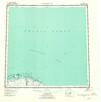
1959 Map of Barter Island
USGS Topo · Published 1961About this map
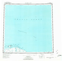
Barter Island and the neighboring coastal lagoons of the Beaufort Sea are captured here in the late 1950s, a period when this remote Arctic shoreline was undergoing survey for navigation and land management. The settlement of Kaktovik sits prominently on the island's northern edge, while nearby Elupak (Site) and various ruins suggest the older habitation patterns of the region. The landscape is defined by a complex network of spits and entrances, including Bernard Spit and the Kuvritovik Entrance, which protected the shallow waters of Arey Lagoon and Kaktovik Lagoon.
Find a feature on this map
32 named features on this map. Tap any name to fly to it.
Don’t see what you’re looking for? This feature index may not catch every label — zoom into the map to look around manually.
Map Details
Editions of this 1959 Barter Island Map
7 editions found

Other maps of this area

1951 · Barter Island
USGS Topo · 1:250,000

1951 · Demarcation Point
USGS Topo · 1:250,000

1951 · Mt. Michelson
USGS Topo · 1:250,000

1955 · Flaxman Island
USGS Topo · 1:250,000

1955 · Demarcation Point
USGS Topo · 1:250,000

1955 · Flaxman Island A-1
USGS Topo · 1:63,360

1955 · Demarcation Point D-3
USGS Topo · 1:63,360

1955 · Barter Island A-5
USGS Topo · 1:63,360

1955 · Demarcation Point D-2
USGS Topo · 1:63,360

1955 · Barter Island A-4
USGS Topo · 1:63,360