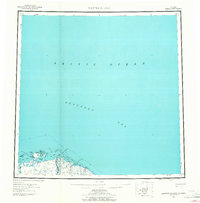
1959 Map of Barter Island
USGS Topo · Published 1965About this map
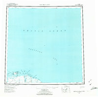
Kaktovik and the coastal landscape of Barter Island dominate this late 1950s survey of the northern Alaskan coast. The map illustrates a transitional period for the Inupiat settlement, showing both the village and a nearby Kaktovik (Site) along the shores of the Beaufort Sea. The geography is defined by a series of barrier islands and spits, including Arey Island and Bernard Spit, which create protected waters like Arey Lagoon and Kaktovik Lagoon. Inland, the braided paths of the Jago River and Okpilak River cut through the tundra, while a lone Tractor Trail provides a rare terrestrial connection across the landscape. Notable navigation and survey markers, such as the VABM Barter 210 Astro, are scattered along the coast near Bernard Hbr and Manning Pt, reflecting the logistical importance of this Arctic outpost during the Cold War era.
Find a feature on this map
34 named features on this map. Tap any name to fly to it.
Don’t see what you’re looking for? This feature index may not catch every label — zoom into the map to look around manually.
Map Details
Editions of this 1959 Barter Island Map
7 editions found

Other maps of this area

1951 · Barter Island
USGS Topo · 1:250,000

1951 · Demarcation Point
USGS Topo · 1:250,000

1951 · Mt. Michelson
USGS Topo · 1:250,000

1955 · Flaxman Island
USGS Topo · 1:250,000

1955 · Demarcation Point
USGS Topo · 1:250,000

1955 · Flaxman Island A-1
USGS Topo · 1:63,360

1955 · Demarcation Point D-3
USGS Topo · 1:63,360

1955 · Barter Island A-5
USGS Topo · 1:63,360

1955 · Demarcation Point D-2
USGS Topo · 1:63,360

1955 · Barter Island A-4
USGS Topo · 1:63,360