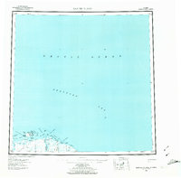
1959 Map of Barter Island
USGS Topo · Published 1974About this map
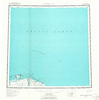
Kaktovik and the coastal landscape of Barter Island dominate this mid-century survey of Alaska's northernmost reaches. The mapping reflects a transition period for the region, where established settlements like the village at Kaktovik are documented alongside a nearby Kaktovik (Site) and various Ruins, suggesting shifts in local habitation patterns. To the east, the shoreline is a complex network of lagoons and spits, including Jago Lagoon and Oruktalik Lagoon, fed by the glacial waters of the Jago River and Okpilak R. Interior features are sparse, characterized by tractor paths and isolated Cabins that hint at the seasonal transit and subsistence living of the era. Surveyors utilized numerous triangulation stations, such as VABM Barter and VABM Astro Az, to plot this remote stretch of the Beaufort Sea coast.
Find a feature on this map
44 named features on this map. Tap any name to fly to it.
Don’t see what you’re looking for? This feature index may not catch every label — zoom into the map to look around manually.
Map Details
Editions of this 1959 Barter Island Map
7 editions found

Other maps of this area

1951 · Barter Island
USGS Topo · 1:250,000

1951 · Demarcation Point
USGS Topo · 1:250,000

1951 · Mt. Michelson
USGS Topo · 1:250,000

1955 · Flaxman Island
USGS Topo · 1:250,000

1955 · Demarcation Point
USGS Topo · 1:250,000

1955 · Flaxman Island A-1
USGS Topo · 1:63,360

1955 · Demarcation Point D-3
USGS Topo · 1:63,360

1955 · Barter Island A-5
USGS Topo · 1:63,360

1955 · Demarcation Point D-2
USGS Topo · 1:63,360

1955 · Barter Island A-4
USGS Topo · 1:63,360