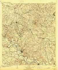
1904 Map of Bastrop
USGS Topo · Published 1929About this map
The Colorado River winds through this Central Texas landscape, defining the character of the river-bottom lands and upland prairies before the modern era of water management. Surveyed in 1899, the map reveals a region dependent on both the river and the expanding rail networks. Transport across the water still relied on points like Nashs Ferry and Burleson Ferry, while the Houston and Texas Central RR and the Missouri Kansas and Texas RR facilitated the growth of towns like Elgin and Bastrop. Local industry is evidenced by a Coal Mine near Sayersville, and the agricultural foundations of the era are visible in the family-named landmarks of Hemphill Prairie and Crafts Prairie. Small rural settlements such as Pottstown Settlement and Mc Duff represent the decentralized community life that preceded the urbanization of the mid-20th century.
Find a feature on this map
76 named features on this map. Tap any name to fly to it.
Don’t see what you’re looking for? This feature index may not catch every label — zoom into the map to look around manually.
Map Details
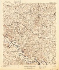
Editions of this 1904 Bastrop Map
3 editions found
Other maps of this area

1885 · Taylor
USGS Topo · 1:125,000

1885 · Bastrop
USGS Topo · 1:125,000

1887 · Taylor
USGS Topo · 1:125,000

1893 · Georgetown
USGS Topo · 1:125,000

1893 · Bastrop
USGS Topo · 1:125,000

1894 · Taylor
USGS Topo · 1:125,000

1896 · Austin
USGS Topo · 1:125,000

1897 · Austin
USGS Topo · 1:125,000

1901 · Flatonia
USGS Topo · 1:125,000

1904 · Bastrop
USGS Topo · 1:125,000