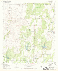
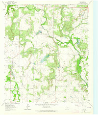
1967 Map of Bead Mountian
USGS Topo · Published 1970About this map
Valera sits at the northern edge of this Coleman County landscape, where the Atchison Topeka and Santa Fe railroad line parallels the highway. The terrain is defined by a dense network of intermittent waterways, including Elm Creek, Panther Creek, and Little Panther Creek, many of which feature numerous spillways and areas subject to controlled inundation. This mid-century survey reveals a rural landscape transitioning toward industrial activity, evidenced by the proliferation of Gas Wells, Oil Wells, and multiple Gravel Pit locations scattered across the ranch land. The prominence of Bead Mountain provides a significant local landmark amidst the drainage basins. Cultural markers like Valera Cem and Voss Cem offer essential points of reference for genealogists tracking family histories in this part of Texas, while the presence of various Pipeline routes underscores the region's role in energy transport during the late 1960s.
Find a feature on this map
27 named features on this map. Tap any name to fly to it.
Don’t see what you’re looking for? This feature index may not catch every label — zoom into the map to look around manually.
Map Details
Editions of this 1967 Bead Mountian Map
2 editions found
Other maps of this area

1887 · Coleman
USGS Topo · 1:125,000

1889 · Coleman
USGS Topo · 1:125,000

1892 · Ballinger
USGS Topo · 1:125,000

1925 · Ballinger 4-c
USGS Topo · 1:48,000

1932 · Voss
USGS Topo · 1:62,500

1954 · Brownwood
USGS Topo · 1:250,000
1962 · Gouldbusk
USGS Topo · 1:24,000
1963 · Coleman
USGS Topo · 1:24,000
1964 · Fisk
USGS Topo · 1:24,000

1967 · Talpa
USGS Topo · 1:24,000