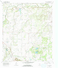
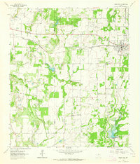
1963 Map of Lake San Tana
USGS Topo · Published 1964About this map
Santa Anna Mountains anchor the southern edge of this central Texas landscape, where the terrain drops toward the drainage basins of Jim Ned Creek and Hords Creek. The early 1960s economy of Coleman County is clearly visible through the extensive Hagler Oil Field and Coleman Junction North Oil Field, marked by numerous drill holes and oil wells interspersed with ranchland. Infrastructure for water management and transport is a primary theme, shown through Lake San Tana, Lake Sealy, and a complex network of pipelines and an aqueduct.
Find a feature on this map
23 named features on this map. Tap any name to fly to it.
Don’t see what you’re looking for? This feature index may not catch every label — zoom into the map to look around manually.
Map Details
Editions of this 1963 Lake San Tana Map
2 editions found
Other maps of this area

1887 · Coleman
USGS Topo · 1:125,000

1889 · Coleman
USGS Topo · 1:125,000

1924 · Brownwood Reservoir Site
USGS Topo · 1:48,000

1927 · Grosvenor
USGS Topo · 1:62,500

1954 · Brownwood
USGS Topo · 1:250,000

1960 · Lake Scarborough
USGS Topo · 1:24,000
1960 · Coleman NE
USGS Topo · 1:24,000
1960 · Burkett
USGS Topo · 1:24,000

1962 · Santa Anna
USGS Topo · 1:24,000
1962 · Bangs West
USGS Topo · 1:24,000