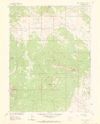
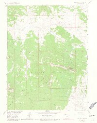
1962 Map of Bears Ears Peaks
USGS Topo · Published 1969About this map
Bears Ears and the twin summits of Bears Ears Peaks dominate this high-altitude landscape within the Routt National Forest. Surveyed for the development of the Missouri River Basin, the map reveals a remote section of the Elkhead Mountains where human presence is defined primarily by resource management and backcountry transit. The California Park Guard Station sits as a lonely outpost near California Creek, serving as a hub for the network of primitive routes like the Pack Trail and Lookout Trail that thread through the timber. Several high mountain basins, including Slater Park and Adams Park, break the dense forest cover, while drainage systems such as Grizzly Creek and Elkhead Creek carve deep valleys through the volcanic terrain. This map captures the region before extensive modernization, preserving the locations of springs and creeks like Cold Spring and Hole-in-the-Wall Creek essential for early high-country travel.
Find a feature on this map
32 named features on this map. Tap any name to fly to it.
Don’t see what you’re looking for? This feature index may not catch every label — zoom into the map to look around manually.
Map Details
Editions of this 1962 Bears Ears Peaks Map
6 editions found

Other maps of this area

1923 · Elkhead Creek
USGS Topo · 1:62,500

1923 · Pilot Knob
USGS Topo · 1:62,500

1924 · Elkhead Creek
USGS Topo · 1:62,500

1925 · Pilot Knob
USGS Topo · 1:62,500

1954 · Craig
USGS Topo · 1:250,000

1957 · Craig
USGS Topo · 1:250,000

1958 · Craig
USGS Topo · 1:250,000

1960 · Craig
USGS Topo · 1:250,000

1962 · Craig
USGS Topo · 1:250,000
1962 · Tumble Mountain
USGS Topo · 1:24,000