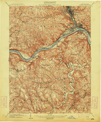
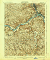
1904 Map of Beaver
USGS Topo · Published 1914About this map
The confluence of the Beaver River and Ohio River anchors this 1904 survey, revealing the intense industrial and transportation hub of Beaver County at the start of the 20th century. High-density settlements like Beaver Falls, New Brighton, and Rochester line the riverbanks, connected by the Pennsylvania RR, which follows the river valleys. The map illustrates the early river infrastructure of the era, including Dam No 5 and Dam No 6, alongside vital crossing points like Cooks Ferry. Beyond the industrial corridors, the landscape gives way to complex drainage systems like Raccoon Creek and Service Creek, where smaller communities such as New Sheffield and Green Garden are situated among the hills. Of particular interest to local historians are the numerous river landings and small neighborhoods like Bolesville and Bakers Landing that speak to the region's river-based economy before modern highway development.
Find a feature on this map
89 named features on this map. Tap any name to fly to it.
Don’t see what you’re looking for? This feature index may not catch every label — zoom into the map to look around manually.
Map Details
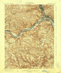
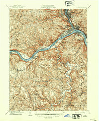
Editions of this 1904 Beaver Map
6 editions found


Historical Maps of Moon Township Through Time
4 maps found