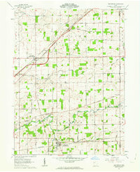
1961 Map of Beaverdam
USGS Topo · Published 1963About this map
Beaverdam and Lafayette anchor this early 1960s survey of western Ohio, where the grid of Congress Lands defines the landscape. The Chicago and St Louis RR and New York RR intersect here, reflecting the heavy rail infrastructure that supported local agriculture and trade. The area is dense with family-named burial grounds and rural congregational centers, such as Gratz Cem, Woodland Cem, and Emmanuel Ch. Waterways including the Ottawa River, Hog Creek, and Sugar Creek carve through the farm lots, often flanked by small woodlots and gravel extractions. The presence of Grange Hall near Emmanuel Ch highlights the importance of agricultural fraternal organizations in the mid-century social fabric of Richland and Jackson townships.
Find a feature on this map
37 named features on this map. Tap any name to fly to it.
Don’t see what you’re looking for? This feature index may not catch every label — zoom into the map to look around manually.
Map Details
Editions of this 1961 Beaverdam Map
3 editions found
Other maps of this area

1906 · Lima
USGS Topo · 1:62,500

1906 · Columbus Grove
USGS Topo · 1:62,500

1907 · Bluffton
USGS Topo · 1:62,500

1908 · Columbus Grove
USGS Topo · 1:62,500

1913 · Alger
USGS Topo · 1:48,000

1915 · Alger
USGS Topo · 1:62,500

1943 · Alger
USGS Topo · 1:62,500

1950 · Marion
USGS Topo · 1:250,000

1953 · Muncie
USGS Topo · 1:250,000

1956 · Muncie
USGS Topo · 1:250,000