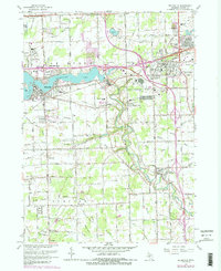
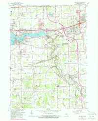
1967 Map of Belleville
USGS Topo · Published 1989About this map
Belleville Lake and the winding Huron River corridor dominate this landscape at a time of significant suburban and industrial expansion in western Wayne County. The map shows the established community of Belleville alongside growing settlements like Belleville North and Romulus. Transportation networks are in a state of flux, with the Chesapeake and Ohio railroad and the Western and Norfolk Line bisecting the terrain, while the massive infrastructure of the Willow Run Airport and Detroit Metropolitan Wayne Co Airport brackets the quadrangle.
Find a feature on this map
96 named features on this map. Tap any name to fly to it.
Don’t see what you’re looking for? This feature index may not catch every label — zoom into the map to look around manually.
Map Details
Editions of this 1967 Belleville Map
5 editions found
Other maps of this area

1902 · South Lyon
USGS Topo · 1:62,500

1902 · Ypsilanti
USGS Topo · 1:62,500

1904 · Ann Arbor
USGS Topo · 1:125,000

1905 · Wayne
USGS Topo · 1:62,500

1906 · Ypsilanti
USGS Topo · 1:62,500

1906 · South Lyon
USGS Topo · 1:62,500

1906 · Romulus
USGS Topo · 1:62,500

1908 · Ann Arbor
USGS Topo · 1:125,000

1912 · Wayne
USGS Topo · 1:62,500

1928 · Romulus
USGS Topo · 1:62,500
Featured Places
- Van Buren Charter Township, MI
- Romulus, MI
- Huron Charter Township, MI
- Sumpter Township, MI
- Belleville, MI